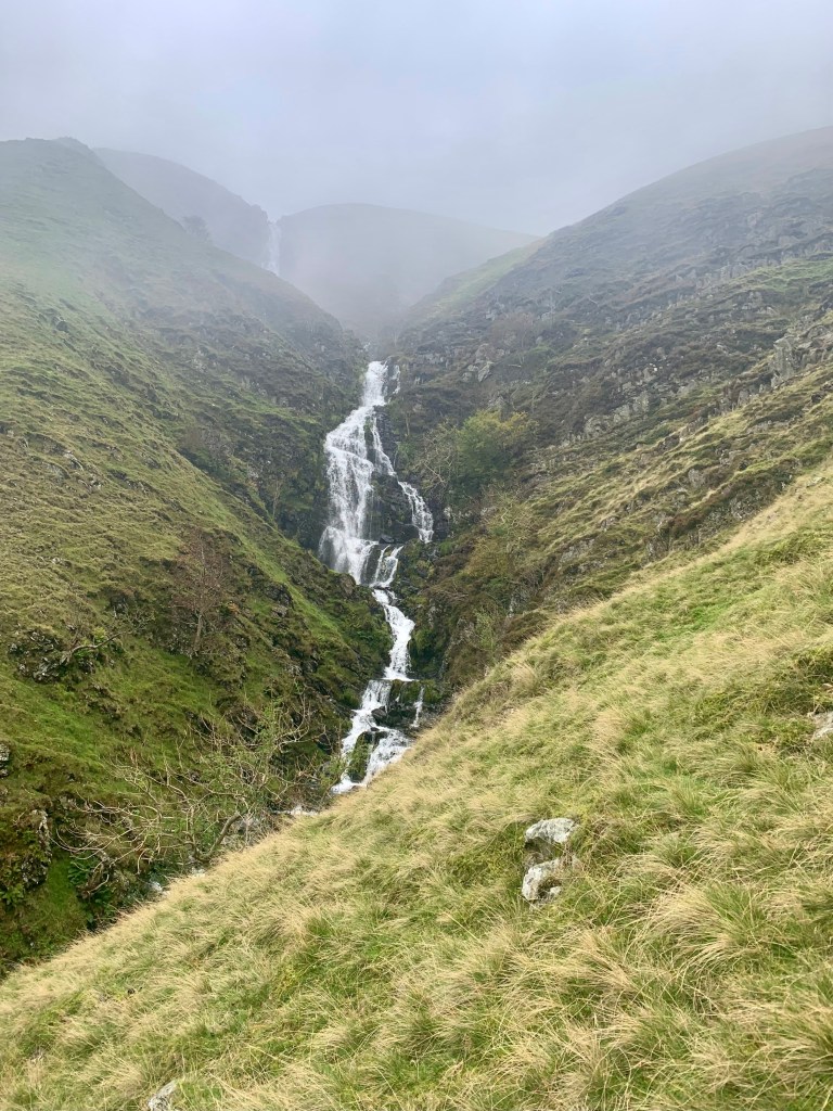
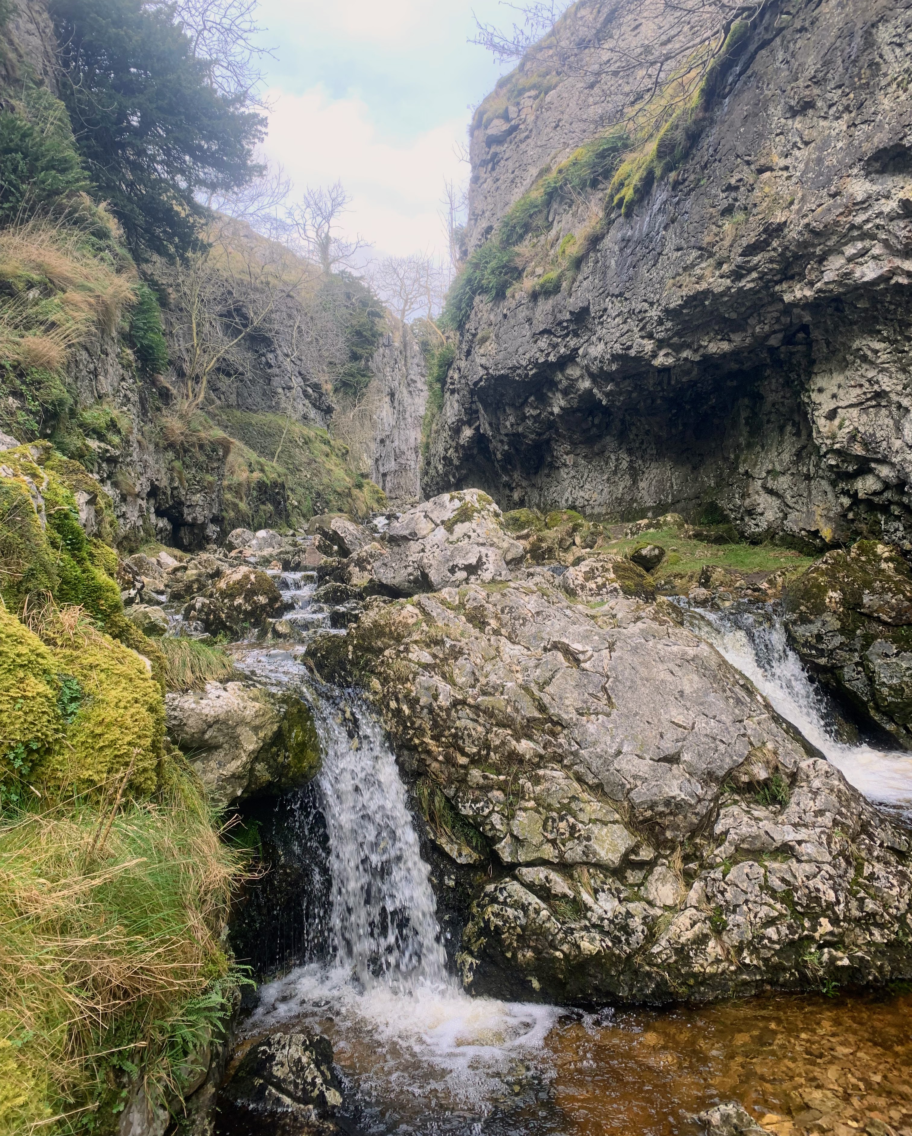
Trollers Ghyll (or Trollers Gill) is a narrow limestone gorge in the Yorkshire Dales, England, near the village of Appletreewick. The ghyll (a Northern English term for a steep valley or ravine) has a mysterious reputation tied to local folk
The gorge is said to be haunted by trolls, hence its name. According to legend, it is home to a fearsome barghest—a supernatural black dog with glowing red eyes, often associated with death and misfortune. Some stories also link the ghyll to mythical goblins and other eerie creatures, adding to its reputation as a place of mystery.
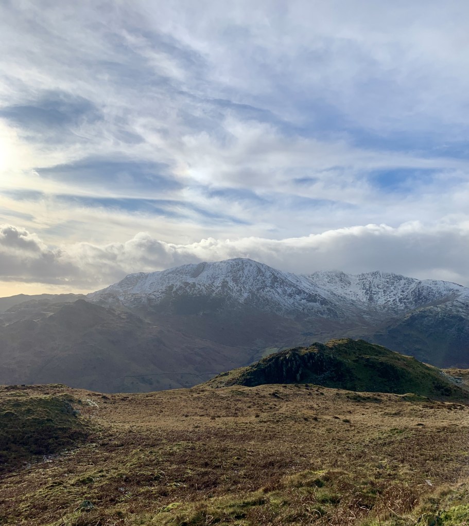
This walk will take you on a 10.5 miles hike from Grimwith Reservoir with some scrambling in the Ghyll. It is ideal for those who are learning to find their feet on rocky and uneven terrain as well as the most seasoned hikers as the views are maginificient.
Stats
| Difficulty | Moderate+ |
| Length | 10.7 mi – 17.2 km |
| Total elevation | 1,394 ft – 425m |
| Highest point | 1,211 ft – 369m |
| Walking time | 4h10 |
| Terrain | mostly hiking paths, river, and Footpath |
| Equipment | Good boots, it can get muddy in Places and you will also be walking on the river’s bed-rock The water may be high in places. Enough water to last you for 4 hours. Plenty of snacks as there are no facilities en route. a good map or gPS |
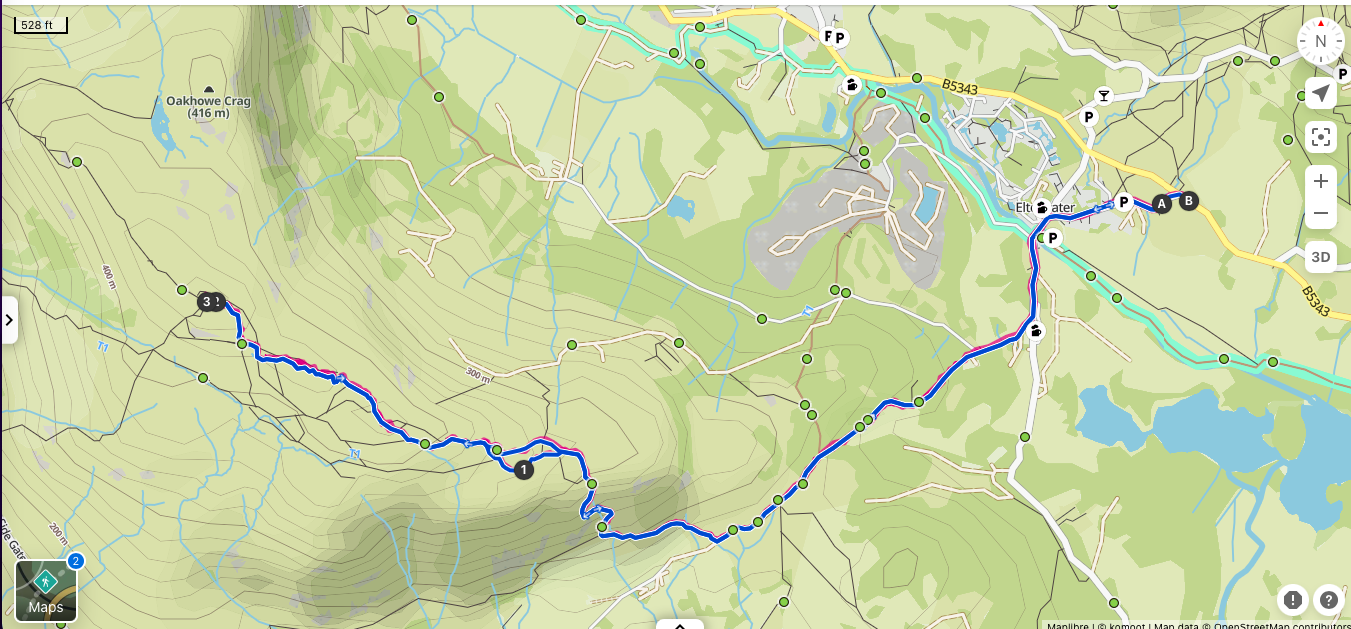
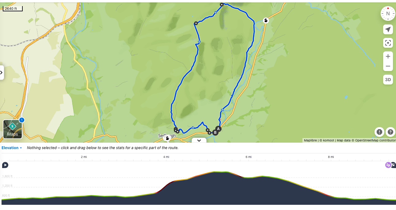
View route (Click on menu to reveal the image)
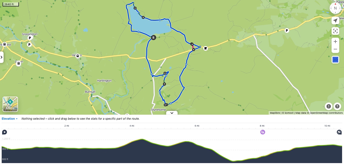
Click here for Komoot Link
Getting there
- Driving: Free car-parking at Grimwith Reservoir – You could also start the walk at Stump Cross Caverns to start and/or finish with their cafes
- Public transport:
- Unfortunately, this walk is not accessible by public transport
Watering Holes
- Cafe at Stumpcross Cavern – c. Mid-way if starting at Grimwith or at start / finish if you opt to start from there
A very cosy licensed cafe with a view .
It produces its own ale and bitter. Also a great place to stop for cake, sandwiches, soup or coffee.
Beer garden for the summer and cosy fireplace in winter.
Open Wed-Sun from 10:00-17:00 (18:00 on Sat & Sun)
Make a week-end of it – Where to stay and eat
This walk is ideally placed in a beautiful part of the Yorkshire Dales where you will find plenty of other walking routes.
And close to some of the prettiest villages in the Yorkshire Dales: Grassington, Burnsall, Appletreewick etc.
For camping and glamping: Howgill Lodge
It offers 4 luxurious and romantic log-cabins with wood-fired private hot-tubs and magnificent views from their private patio area.
Of course all lodges comes with full ensuite bathroom and kitchen.
47 Grass tent pitches with or without electric hookups.
And 19 gravel pitches for motorhomes and caravans with electric hookup.
An award winning campsite. With outstanding shower facilities,
The farm is also home some alpacas. And close to two excellent pubs
For a romantic experience: Howgill Lodge wood cabins
For self-catering options: 4 Skyreholme Mill Cottage
It accommodates 6 in 3 bedrooms (King, double and twin)
2 nights minimum booking
For a cosy stay: Orchard House B&B – Hebden
A small B&B in the village of Hebden. They have a double with private bathroom and an ensuite twin room.
Reasonably priced for the area. It is a peaceful place where you can escape everyone and everything.
And Hebden has a cracking village pub.
For a luxurious experience: The Devonshire Fell Hotel – Burnsall
A 4 star luxury hotel in the beautiful village of Burnsall.
The restaurant serves exceptional food.