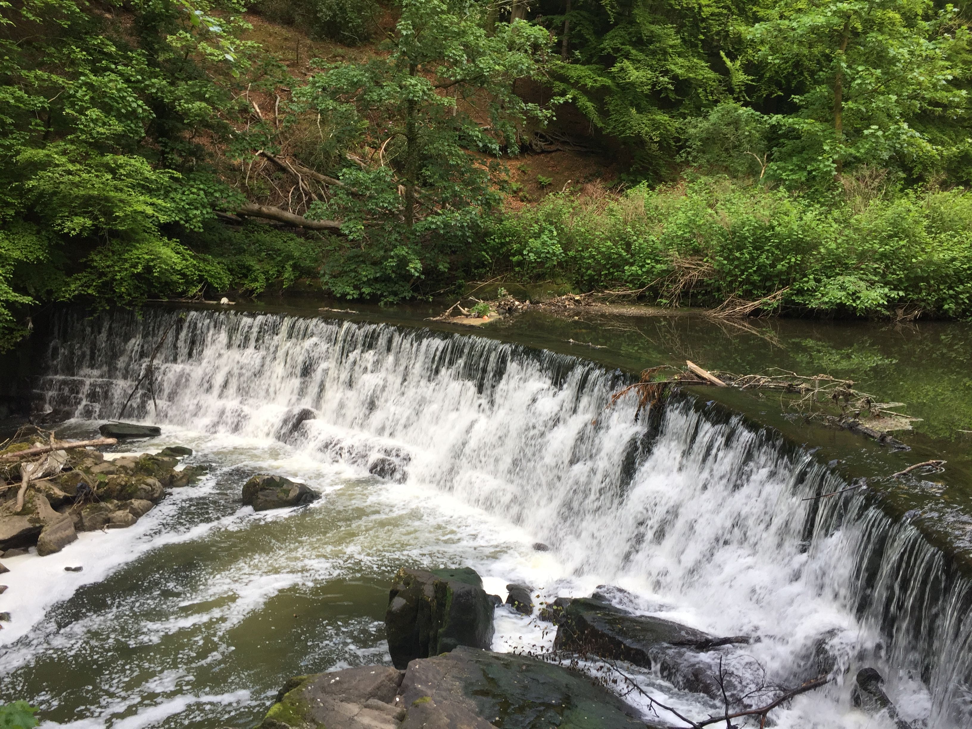
Make the most of the few longer days we have remaining this year. This walk is under 7 miles and can be completed after work.
Click on the picture to see the full slideshow and route videoStats
Difficulty
Easy
Length
6.8 mi – 11.2 km
Total elevation
757 ft – 231m
Highest point
350 ft – 106m
Walking time
2h36
Terrain
Paths, roads and hiking paths
Equipment
Waterproof shoes or boots – Can be muddy in some sections
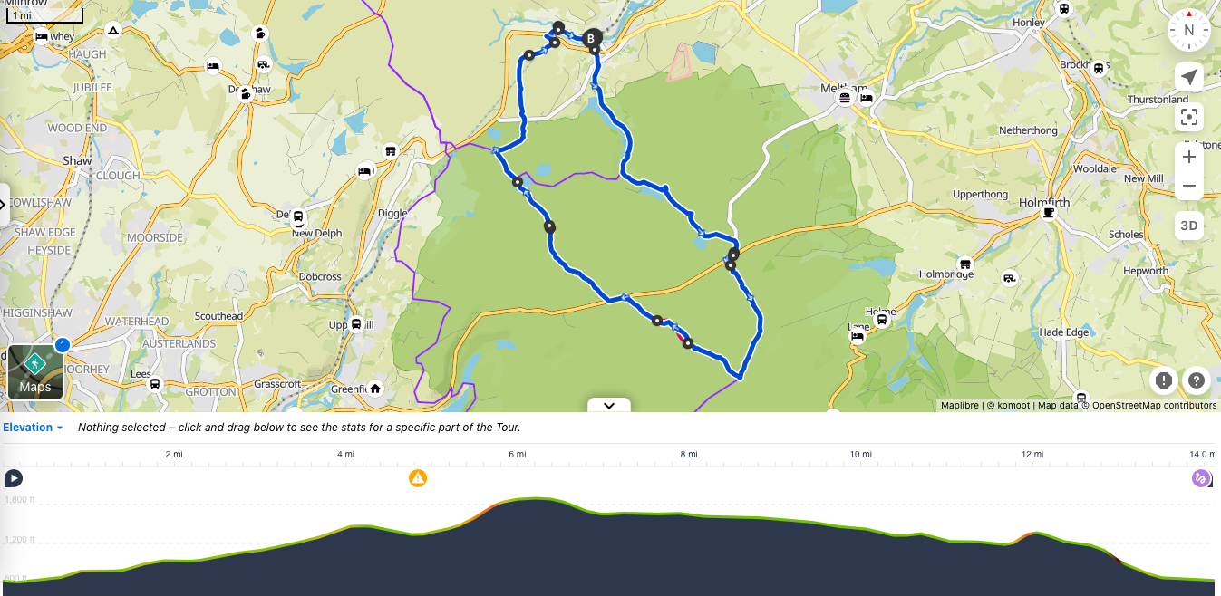
View route (Click on menu to reveal the image)Send me a message on Instagram or email to request the GPX file, AllTrails or Komoot linkGetting there
Driving: Car park Tower Road and Pleasington car parks are free
Public transport:
From Manchester: Train from Victoria to Blackburn then train to Cherry Tree (c. 1h35) or Train from Piccadilly to Preston and then Preston to Cherry Tree (c. 1h30)
From Preston: Bus 152 to Tower Road stop (c. 40 mins)
From Leeds: Train to Accrington then train to Cherry Tree (c. 1h59)
From Lancaster: Train to Preston then train to Cherry Tree (c. 1h20)
Watering Holes
The Railway – Pleasington – 5.4 miles into the walk (c. 2hrs) Muddy boots and paws friendly. The walker’s favourite in the area. A good selection of ales and some outdoors seating in the summer.
The Butler’s Arms – Pleasington – Less than a mile into the walk (c. 25 mins) For the gourmets and oenophiles. The pub offers French cheese and wine tastings with their sommelier But also has a good selection of ales for a quick pint at the start or at the end of the walk. And serves pub classics, grills, gastro dishes and burgers from 12:00-20:00 Mon-Thur and 12:00-21:00 Fri & Sat as well as Roast on Sundays from 12:00-20:00. If you are walking during the week, there is an excellent value lunch menu on Mon-Thur. Some outdoors seating with a bowling green in the Summer, open-fire in the winter and the pub is dog-friendly
Make a week-end of it
The area is better suited for locals as a day or evening walk.
Click on the picture to see the full slideshow and route videoStats
Difficulty
Strenuous (From the distance)
Length
14.2 mi – 23 km
Total elevation
2,733 ft – 833m
Highest point
1, 897 ft – 578m
Walking time
5h20
Terrain
Paths, footpaths and moors
Equipment
Sufficient water for 14 miles (no pubs or shops en-route on this one) ; good waterproof shoes as the moors are boggy
View route (Click on menu to reveal the image)Send me a message by email or on Instagram to request the GPX file, AllTrails or Komoot link all files can be customized with your chosen departure points and/or to include sights along the trail. Getting there
Driving: There is a free car-park on Station Road and one on Argyle street
Public transport:
From Manchester: Direct train from Piccadilly (Takes less than half an hour!). Alternatively, take the train from Victoria and change at Huddersfield
From Preston: Train to Manchester Piccadilly and then train to Marsden (c. 1h40)
From Leeds: Train to Huddersfield and then train to Marsden (c. 55 mins)
From York: Direct trains to Marsden (c. 1h10)
From Sheffield: Train to Huddersfield and then train to Marsden (c. 1h30)
Contact me for other routes
Watering Holes
The Riverhead Brewery tap – Marsden- after the hike. Part of the Ossett Brewery – The pub makes some of its own ale on site. And also stocks some local favorite such as Butterly and Redbrook. (Named after the local reservoirs) Probably my favorite for beer in Marsden. But beware this is a trendy micro-brewery rather than quaint village pub. It does serve food but trendy Asian fusion (i.e Bao Buns) rather than your traditional pub fare. There is outside seating if the sun is shining.
The New Inn – Marsden – after the hike of pubs and cafes in Haworth If you are after something more traditional and a great Sunday lunch; this is the place to go to in Marsden. A traditional Country pub with roaring fire in the winter and a beer garden in summer. Muddy boots and paws are always welcome. The food is traditional, uses local ingredients and home-cooked. Served Mon-Thu from 17:00 to 20:00, from 12:00 to 20:00 on Fri & Sat and 12:00-19:00 on Sundays.
Make a week-end of it
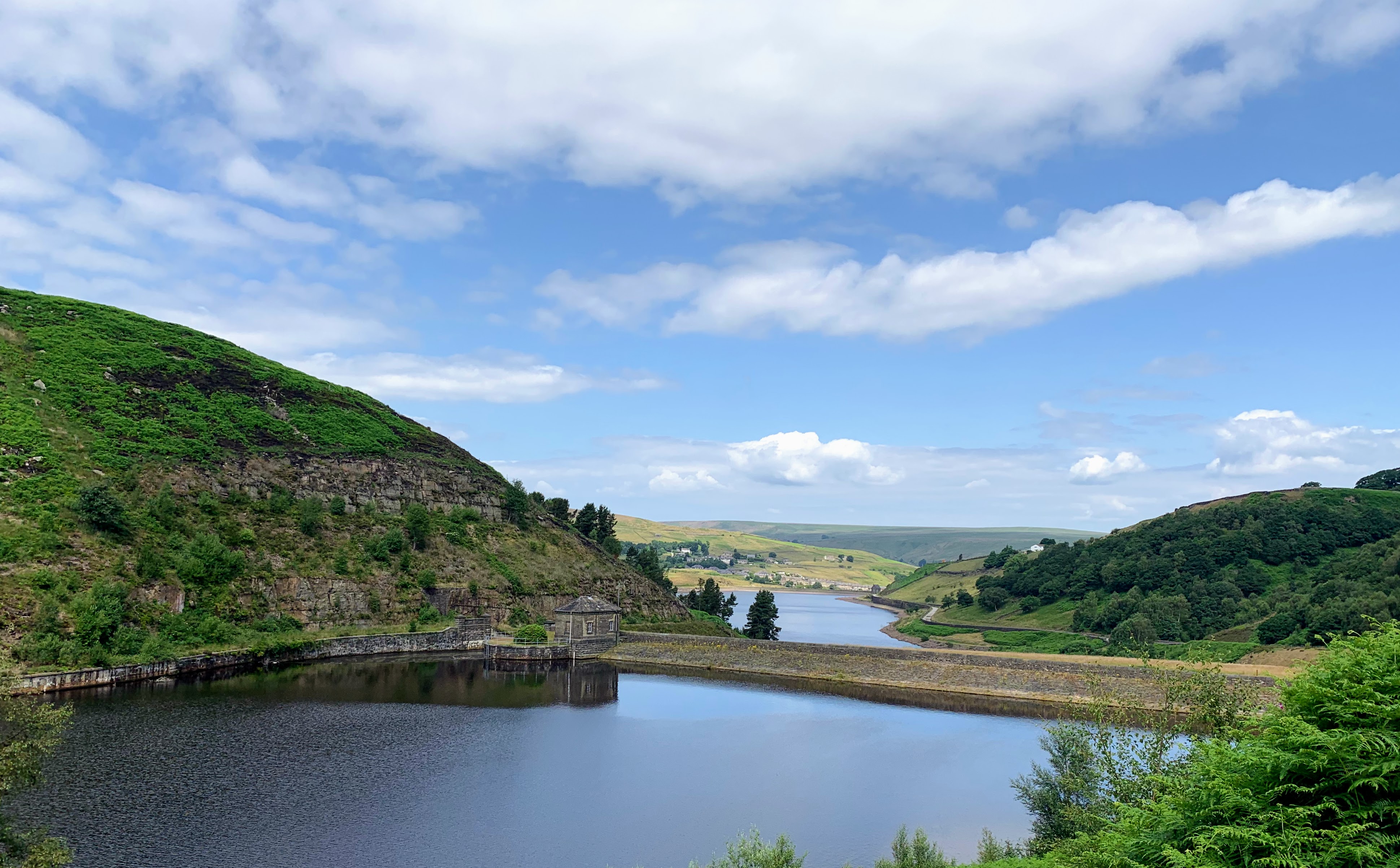
Marsden is a very pleasant village in the South Pennines. Being on the edge of the Peak Districts; there are plenty of walks that can be started from Marsden. And the village has enough coffee shops, pubs, bars and restaurant to keep you entertained for the week-end. Being minutes away from Leeds, and easily accessible by public transport; yet with beautiful country surrounding it will cater for a very wide crowd. Suprisingly, there isn’t a wide range of accommodation in Marsden.
The New Inn does offer 6 cosy rooms above the pub. Check the Watering Holes section for more details.
There are a few self-catering options for families and groups of friend. Check AirBnB and Booking for options. There are a couple in the centre of the village. But for a real county-side week-end; my favorite is about 35 mins walk from the centre. Hey Farm Barn: It sleeps 2 people in the bedroom and can accommodate a further two people or children on the sofa-bed. Plenty of walking and cycling from its door-step.
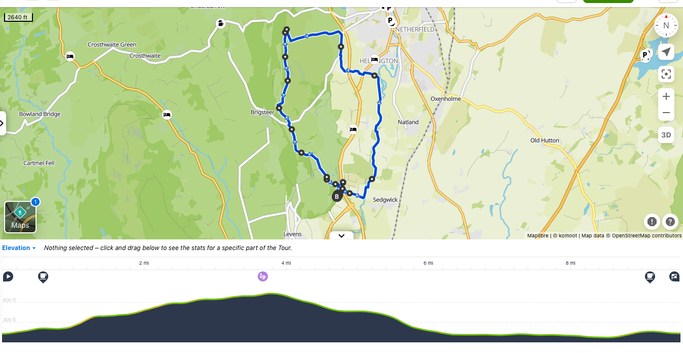
This low-level walk near Kendal is under 10miles but punches above its weight. It takes in a medieval castle owned by the National Trust, a cafe and farm-shop where you watch the cows being milked and a pub that serves delicious food.
Click on the picture to see the full slideshow and route videoStats
Difficulty
Moderate
Length
10 mi – 16.2 km
Total elevation
1,506 ft – 459m
Highest point
735ft – 224m
Walking time
4h15
Terrain
paths, roads, walking paths, streets
Equipment
Enough water to walk 8 miles or 3h30. There is a cafe at the Beginning and the end but nothing in between.
View route (Click on menu to reveal the image)Send me a message on Instagram or email to request the GPX file, AllTrails or Komoot linkGetting there
Driving: 6 free car-parks along the way: On Nannypie Lane before the Stricklands Arm / Near St John’s Church Helsington / Underbarrow Road before the paid Scout-scar car-park / Brigsteer Road / Scroggs Lane / Hawes Lane
Public transport: Kendal Bus X6 to the Approach stop (C. 20 mins)
From Manchester: Train to Carnforth then bus 755 to the Approach stop (c. 2h05)
From Preston: Train to Arnside then bus 552 to the Approach Stop (c. 1h50)
From Lancaster: Bus 555 to Ashbank lane stop (c. 45mins)
From Carlisle: Train to Kendal then Bus 555 to Ashbank lane stop (c. 1h35)
Watering Holes
The cafe at Sizergh Castle – Sizergh – C. half a mile after the start (15 mins). National Trust Cafe This is handy if you have forgotten water, your lunch or want a perk me up coffee before starting the walk.
Wheatsheaf Inn – Brigsteer – Technically not on the original route, but worth the small detour. It would only be 2.29 miles in (c. 1h00) and would add an extra mile to your walk. Happy to customize the gpx, AllTrails or Komoot to include on the route. Owned by Robinsons breweries. This cosy tenanted pub offers good ales, pies, pub classics and sandwiches; a beer garden for the summer and a roaring log-fire in the winter. Food served from 12:00-15:00 and 17:00-20:00 Monday – Thursday and 12:00 to 20:00 on Friday to Sunday. The pub also has 6 rooms. (See below sections). Muddy paws and boots are always welcome.
Romneys – Helsington / Kendal – Again, not on the route but a detour worth making. This would be at the 6.5 miles (c. 3 hrs) and would add an extra mile to the walk. It is a traditional Cumbrian pub with rooms. The local ale and food with delicious pub classics, carvery on Sunday. Prices are very reasonable for the area and there are several options in the children’s menu. Beer garden with a children’s play area, log-fire for the winter and dogs are welcome. The pub also offers accommodation (see below section for details)
Low Sizergh Barn Cafe – Sizergh – C. 9.2 miles after the start (4h00). The best one if you are walking with the kids – A dairy parlor where you can watch the cows being milked at 15:30. Delicious ice-creams, farm-shop and the raw milk is on sale.
The Strickland Arms – Sizergh – At the end (or beginning) of the walk. The best for gourmets – it is listed in Michelin and Good Food guide. The food is home-made and cooked to order. The ale is just as good and the pub recommended by the good beer guide. A favorite with the locals and dog-owners. It is a very cosy pub with a large beer-garden, outside dining with a view and a roaring fire.
Make a week-end of it – Why South Lakes and Kendal ?
For those who have never visited the Lake Districts, Kendal is not a bad place to start from. The first largest town in the National Park, yet less crowded with tourists and more down to earth than Windermere. You will find the genuine cumbrian hospitality that made the region, a good selection of places to eat and drink; shops for the outdoors enthusiast offering better value than their counter-parts in Ambleside and further north. A farmer’s market and great brewery for the foodies. There is an array of scenic low-level walks in the area and good bus connections to the Lakes.
For the seasoned mountaineers and fell-walkers a wet and cold day on the fells is not always a pleasant experience. Whether you have ticked all all your Wainwrights already you do not fancy a high-level walk with poor visibility on a day where the weather is unkind; the outlying fells are perfect to keep you ticking.
For the culture enthusiasts there are multitude of place to visit around Kendal: Sizergh Castle, a medieval castle owned by the National Trust; the Levens Hall, an Elizabethan country manor with gardens and a deer park; Abbot Hall art gallery for fine art from the 18th-20th century and last but not least, the Kendal Museum with its collections of Natural History, Cumbrian history and World Wildlife gallery
For the adventurers: Kendal has a climbing hall, Adventure Makers has a meeting point not far from the climbing centre and offers guides to take you Ghyll scrambling, Canyoning, and caving.
Make a week-end of it – Where to stay and eat
For walkers: The Weatsheaf Inn The Inn has 6 cosy rooms above its pub
For a lazy Sunday: Romneys in Helsington offers 5 self-catering cottages and 5 snugs. Very close to both Kendal town centre and the walk route. Stay overnight and enjoy an amazing Sunday Lunch at the pub.
For the campers and families: Sizergh Barn and Farm – tent and caravan pitches as well as a glamping pods that sleeps 4 and has a kitchenette. Enjoy the walk, a visit to Sizergh Castle with a unique stay on an Organic Dairy farm. It has an award winning farm shop and cafe. Sells raw milk and you can watch the cows being milked everyday at 15:30.
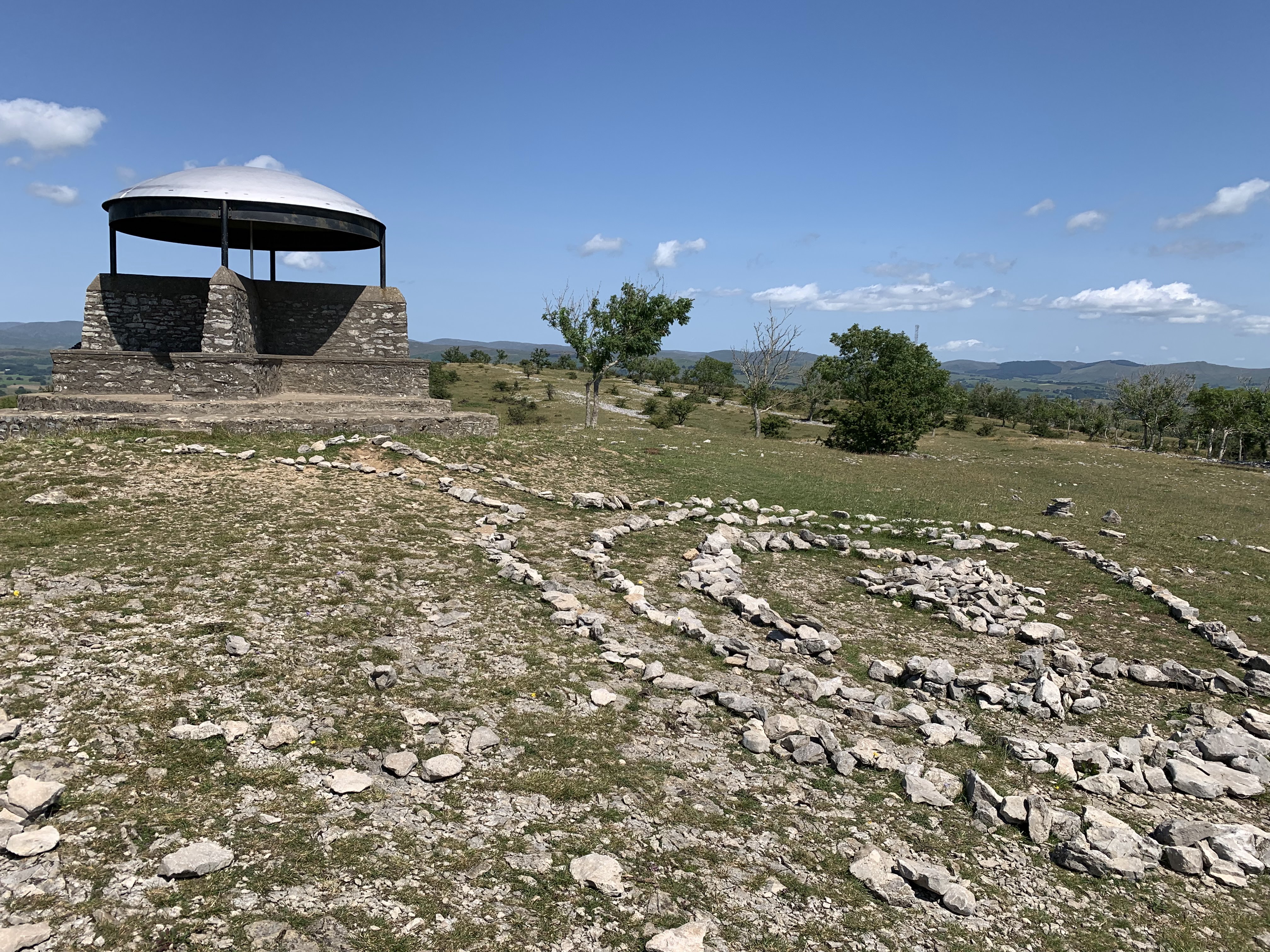
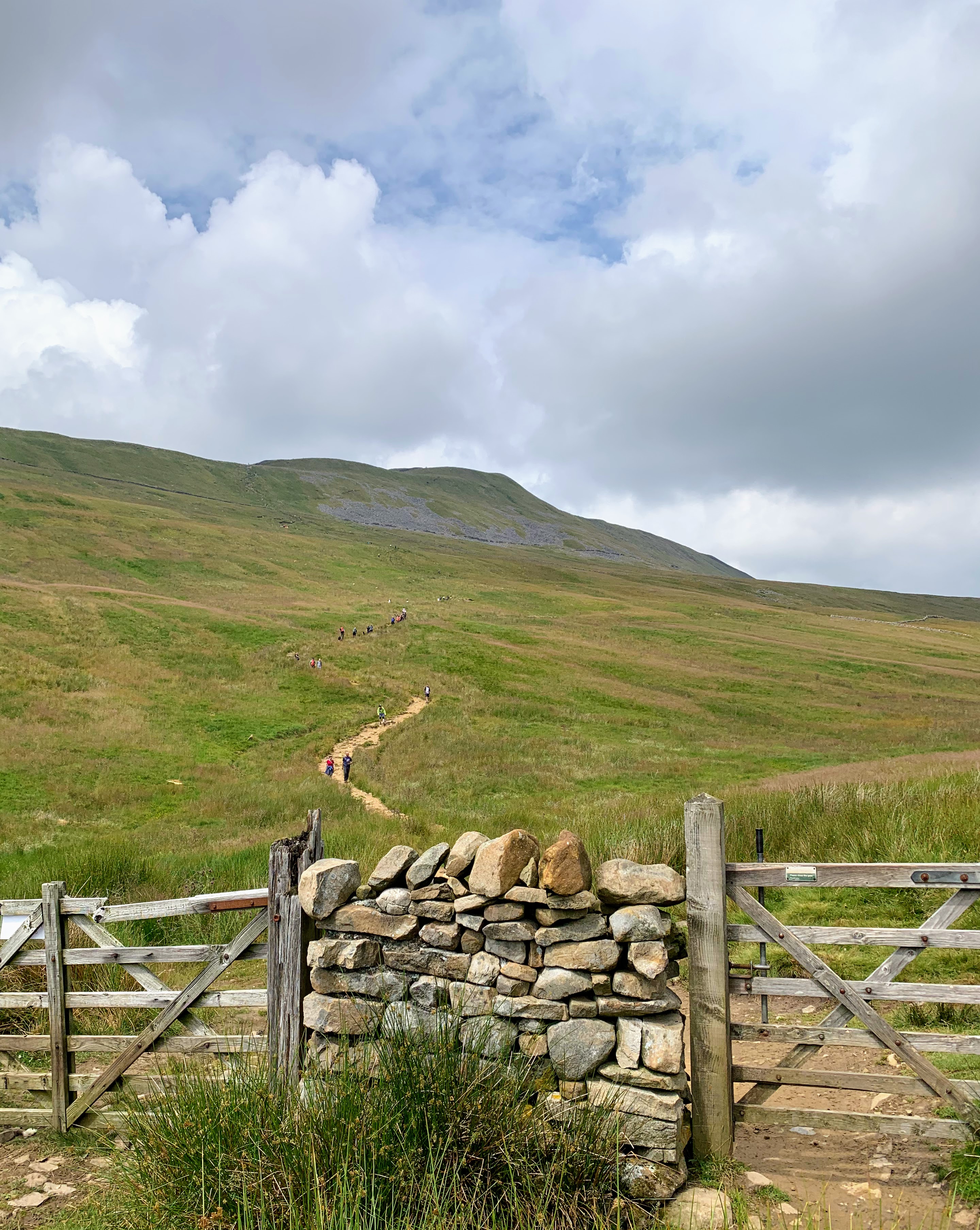
Whernside is the highest of the Yorkshire Three Peaks but the easiest to climb, if you want to enjoy a first fell hike or thinking about doing the 3 peaks but starting separately; Whernside is ideal. It is the closest to Ingleborough if you decided to summit each on separate days over the week-end.
Click on the picture to see the full slideshow and route videoStats
Difficulty
Moderate to Strenuous (from the elevation)
Length
9 mi – 14.5 km
Total elevation
1,969 ft – 600m
Highest point
2,415ft – 736m
Walking time
3h40
Terrain
Walking paths, paths, roads and boulders. You will need good knees for the descent
Equipment
Enough water (no pubs until c. 3/4 of the way) – Layers (The Summit is above 2,000ft – it will always be colder and windier on top than in the valley)
View route (Click on menu to reveal the image)Send me a message on Instagram or email to request the GPX file, AllTrails or Komoot linkGetting there
Driving: Car Park next to Ribblehead train station or on Blea Moor Road (near the Station Inn Pub)
Public transport: Ribblehead train station
From Manchester: Direct trains from Victoria (c. 2h05)
From Leeds: Direct trains (c. 1h20)
From Preston: Train to Blackburn then to Ribblehead (c. 1h35)
From Lancaster: Train to Long Preston and then to Ribblehead (c. 1h20)
From Carlisle: Direct trains c. (c. 1h25)
From York: Train to Leeds than to Ribblehead (c. 1h50)
Watering Holes
The Old Hill Inn – Chapel-le-Dale – C. 7.2 miles after the start (3h30). An amazing family run pub in a building dating 1615. Real ale with locally sourced and home cooked food do call the venue to check opening and serving hours as they do vary. An old-fashioned walker’s bar and inn; muddy boots and paws will alway receive a warm welcome. And a roaring wood-fire will help you warm up or dry off on colder days. It also offers camping and accommodation (see below section for details) .
The Station Inn – Ribblehead – At the end of the walk Independent pub with good ales, home-made food, a beer garden in the Summer and wood-fire in the winter. Food served from 12:00-21:00 every day. Expect traditional pub-food. The pies are made entirely from scratch, including the pastry ! As the pub is not tied to any brewery, you will find the owner’s own choice of locally brewed ales chosen for its quality. From time to time, you will find live music. The pub also offers camping and accommodation (see below sections for details)
Make a week-end of it
Being on the Yorkshire Three Peaks route, the area is geared up for outdoors enthusiast. If you are after heights, but do not feel ready for the full challenge; you could climb Whernside on a day and Ingleborough on the next. If you prefer a lower walk on one of the day; there are an abundance of options: the Dales Highway, the Pennine journey trail, the limestone walk, the Ribble way, etc. The area is also popular for caving with numerous caves nearby and cycling with green lanes.
The Old Hill Inn is my favourite in the area and the best location to take in both Whenside and Ingleborough over the week-end.
It offers two cosy bedrooms above the pub, some glamping pods, all with their own bathrooms and toilets and a few pitches for caravan and motorhomes. The glamping pods are perfect for a couple of friends sharing as they only have bunk beds though. The pitches are only suitable for fully equipped motorhomes and caravans as they offer water and electric hookups but not toilet facilities.
The Station Inn is the better options if you travel by public transport as it is right next to the train station. Also the best location to include caving or cycling in your week-end. There are 6 bedrooms with views of the mountains. For group of friends or families; the pub also has 3 bunk-house but each must be rented by the same groups of 6 or 8. Each unit has en-suite facilities, sheets are provided but you need to bring your own sleeping bag. Finally, the pub has spaces for motorhomes. Free of charge as long as you use the pub for meals. You do not need to have a fully equipped camper as there are portaloos and sinks available for out of hours. But the pitches do not have electric hookups.
The Old School bunkhouse, next to the Old Hill Inns is a great option for groups of friends or solo-travelers. But this is often booked out as a whole unit, in particular during school terms. Check in advance for smaller groups or individual bookings. It has 5 bunk rooms and 5 bathrooms. Will accommodate groups of up to 26 people.
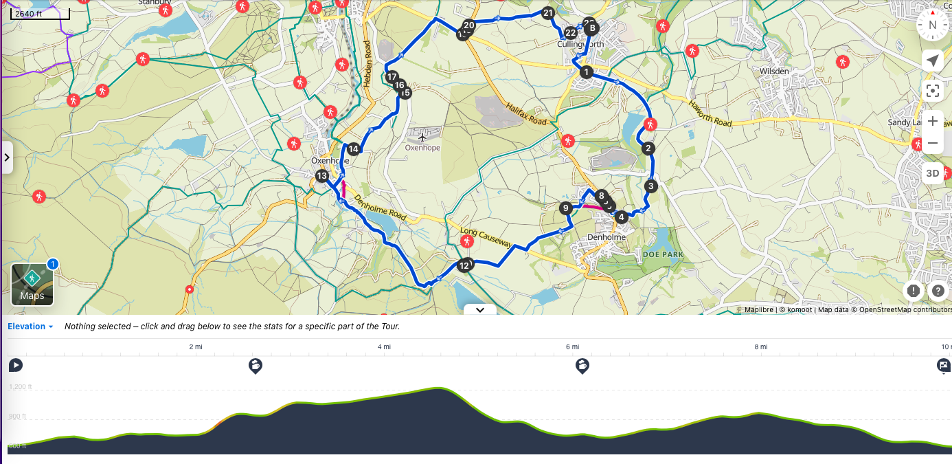
Click on the picture to see the full slideshow and route videoStats
Difficulty
Moderate
Length
9.6 mi – 15.5 km
Total elevation
1,509 ft – 460m
Highest point
1,217 ft – 370m
Walking time
4h25
Terrain
Paths, streets, roads and footpaths
Equipment
Sufficient amount of water for a four and a half hours walk
View route (Click on menu to reveal the image)Send me a message by email or on Instagram to request the GPX file, AllTrails or Komoot link all files can be customized with your chosen departure points and/or to include sights along the trail. Getting there
Driving: Several car-parks in Cullingworth
Public transport:
From York: Train to Bradford Interchange then bus K4 to Cullingworth (c. 1h55)
From Leeds: Train to Bingley and bus K4 to Cullingworth (c. 46 mins)
Watering Holes
The Bay Horse Inn – Oxenhope – c. 6.2 miles into the walk (2h45) A great village pub where both locals and visitors are welcome. Outdoor seating in the summer. Good selection of excellent cask ales and recognised by CAMRA. Unfortunately, no food served.
Plenty of pubs and cafes in Haworth – small detour from the walk I will make a separate post for those.
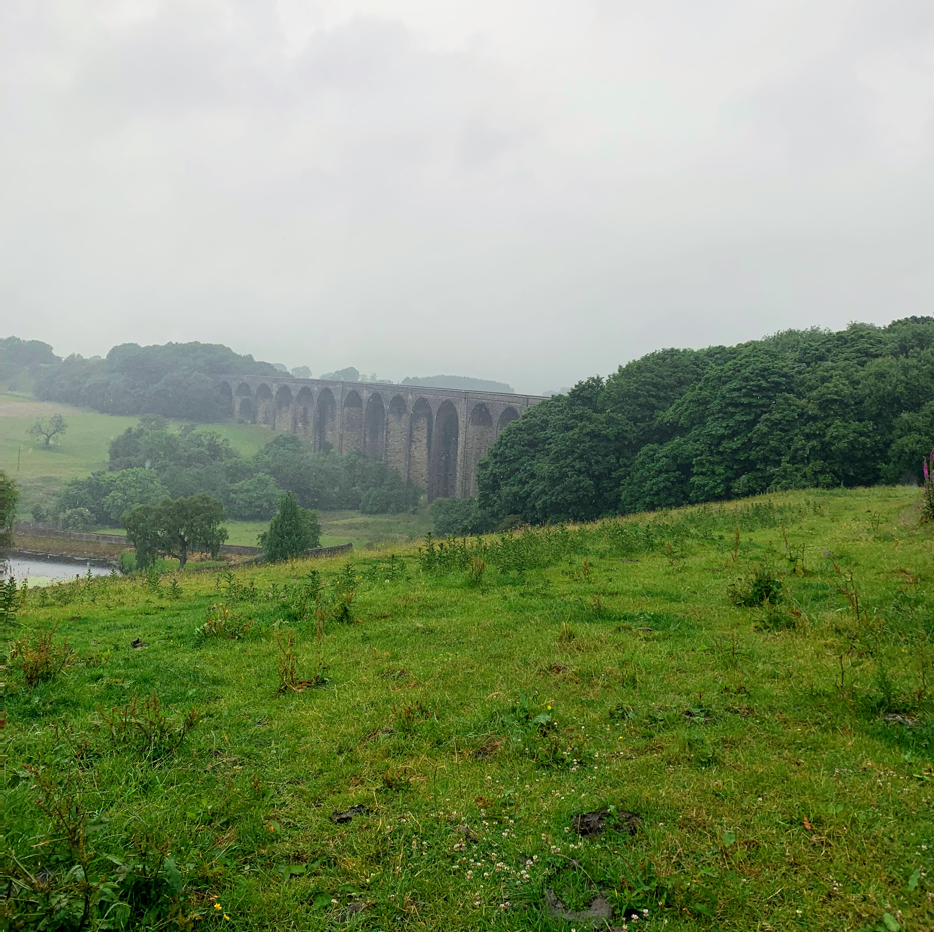
Make a week-end of it
Haworth is a fantastic village. Visit the Brontë sisters parsonage, independent shops, cafes, pubs and restaurants. Check my other post for more details.