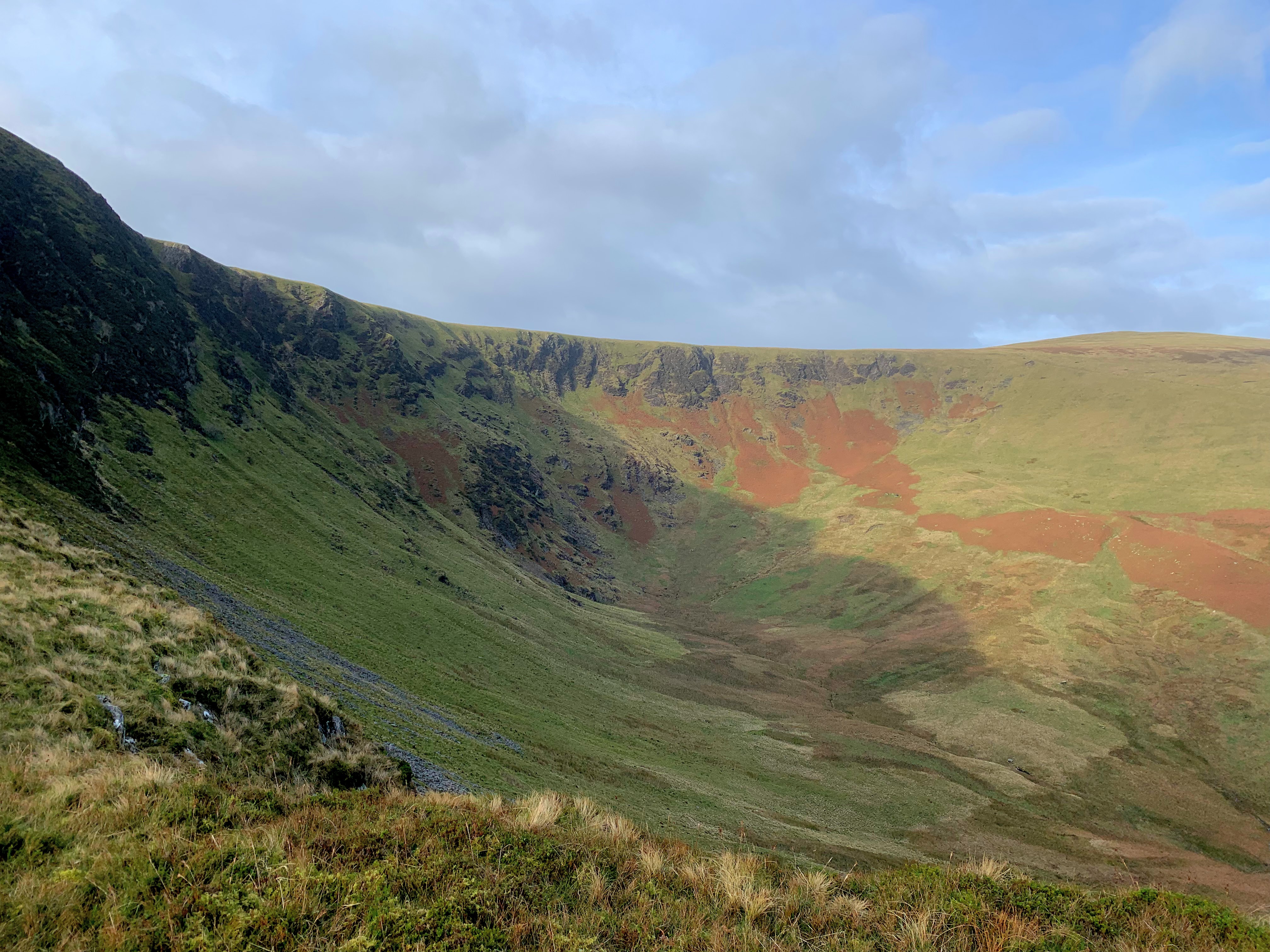
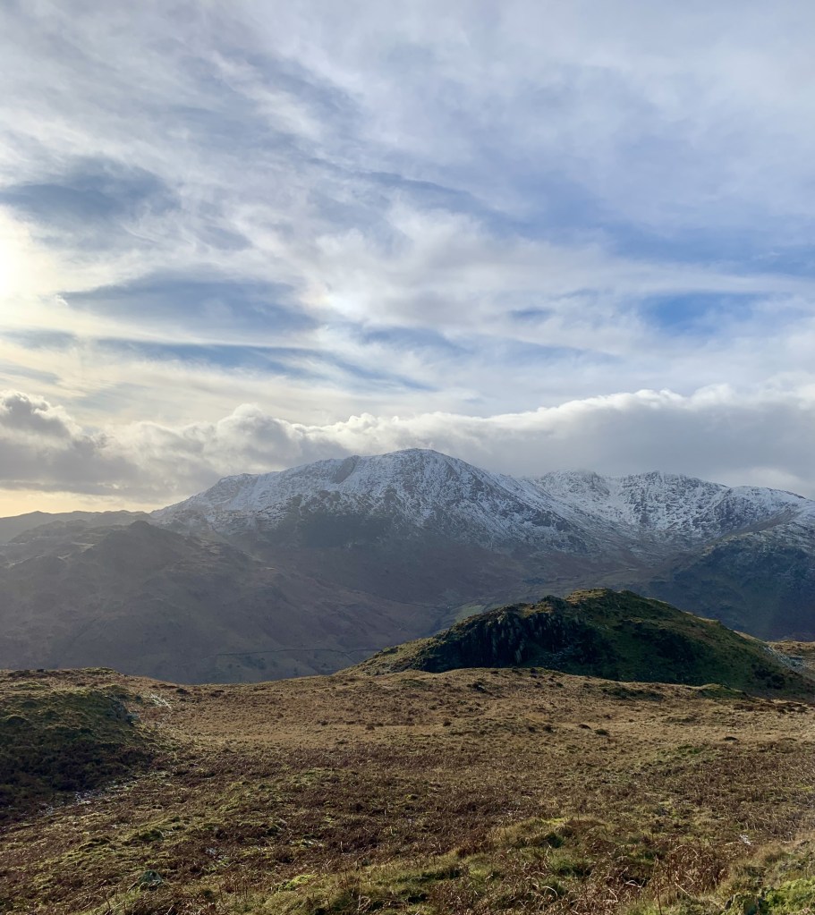
Lingmoor Fell, although quite low offers some of the best views in the Lake District. It includes the Coniston range with the distinctive Wetherlam and the iconic Langdale Pikes.
It is an isolated fell, and as we were in Elterwater, we did it as a quick up and down.
But you could use another route to include fat-man squeeze and/or Blea Tarn.
It doesn’t require any technical skills but as there are an array of paths at the start, do not forget your map or GPS. The actual summit is also known as Brown Howe.
The Langdales are at the heart of Lake District and simply paradise for walking, hiking, cycling or climbing. You can easily make a week-end of it. But don’t expect the facilities of Ambleside or Keswick.
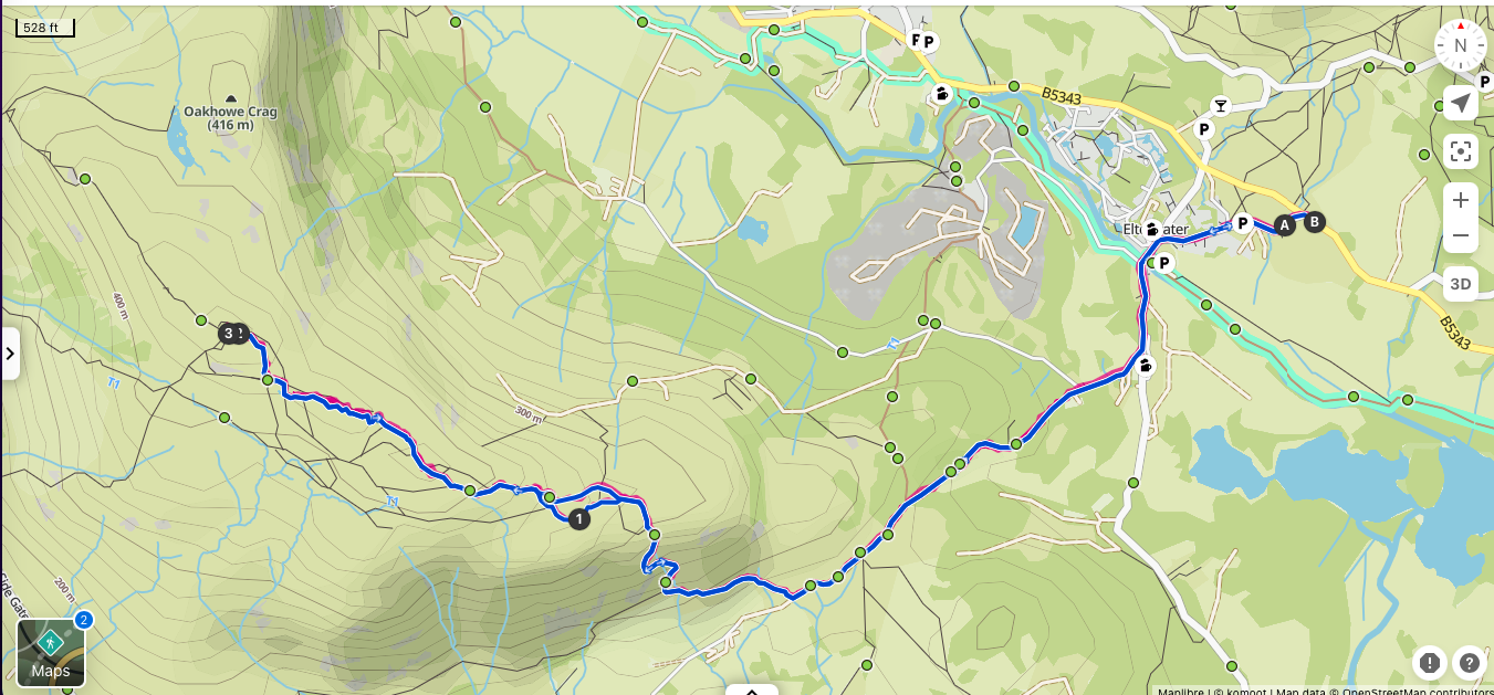
Stats
| Difficulty | Moderate |
| Length | 5.5 mi – 8.8 km |
| Total elevation | 1,460 ft – 445m |
| Highest point | 1,538 ft – 469m |
| Walking time | 3h00 |
| Terrain | mostly hiking paths, footpath and road |
| Equipment | Good shoes, it can get muddy in places. Enough water to last you for 3 hours. Plenty of snacks as there are no facilities en route. a good map or gPS |
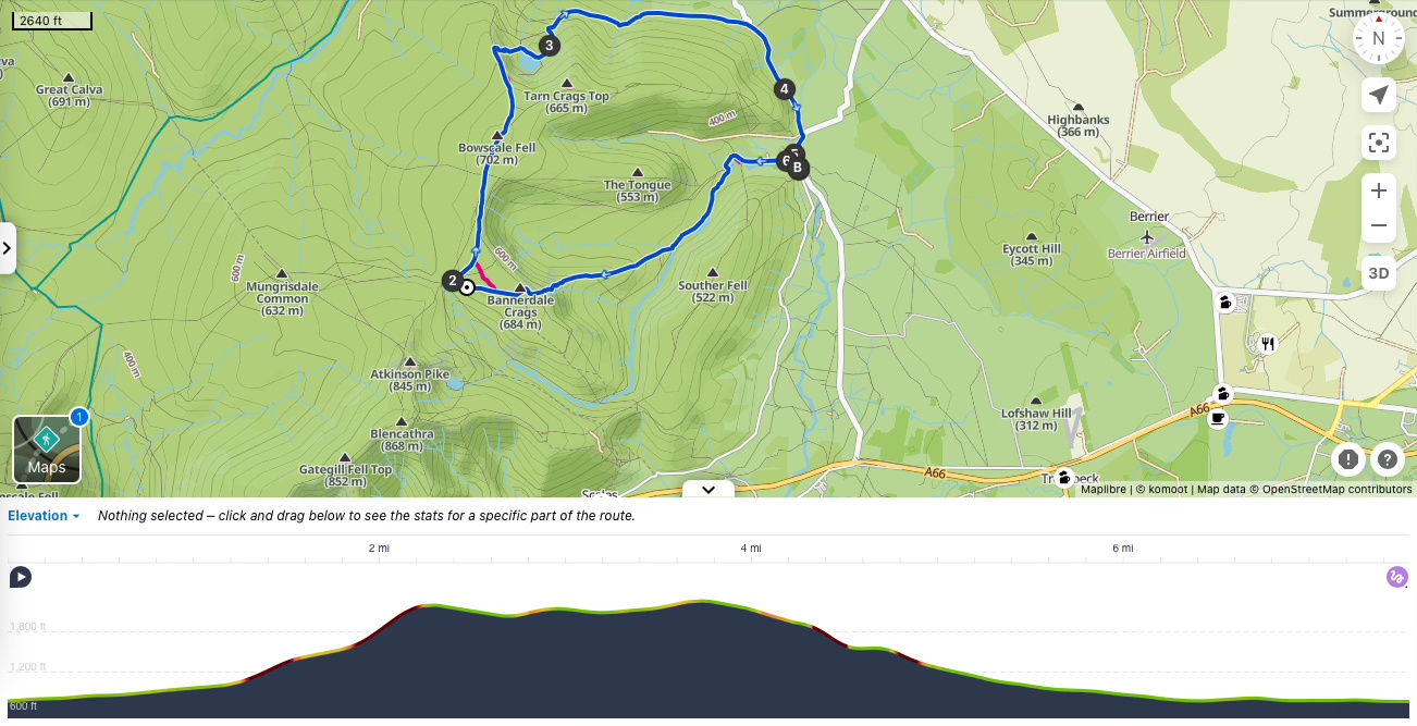
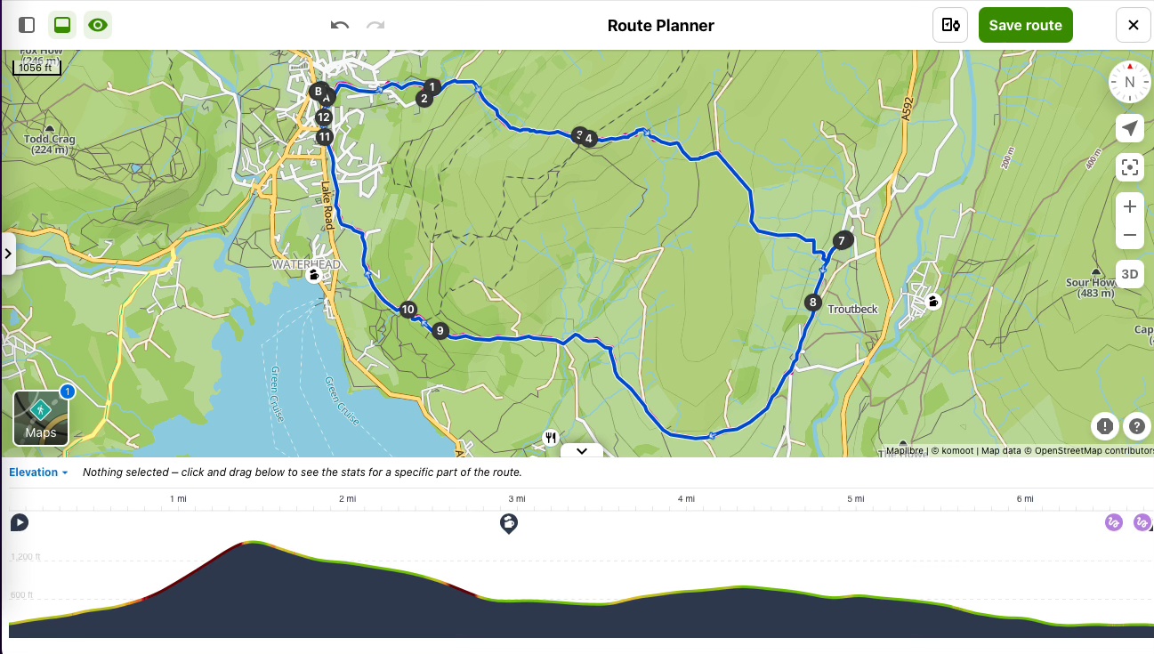
View route (Click on menu to reveal the image)
Getting there
- Driving: There are a few laybys (Free) outside Elterwater but do get there early
- Public transport:
- From Preston: Train to Oxenholme then train to Windermere then bus to the Britannia Inn (c. 1h50)
- From Lancaster: Train to Oxenholme then train to Windermere then bus to the Britannia Inn (c. 1h40)
- From Carlisle: Train to Oxenholme then train to Windermere then bus to the Britannia Inn (c. 2hrs)
Watering Holes
- The Britannia Inn – Elterwater – at the end of the walk.
A cosy and traditional Cumbrian pub and Inn. Muddy boots and paws are welcome and there.
Outdoor seating in the summer and roaring fireplace in the winter
The food is rustic and uses fresh local produce, I particularly like the minted South Lakes lamb Henry. They offer no less than 6 kinds of Cumbrian ales.
The kitchen is open from 12:00 to 14:00 for lunch, 14:00-16:00 for soups and sandwiches and 17:30-20:30 for supper every-day. - Lanty Slee – Elterwater
Not technically on the route but a few steps outside the village.
Fuel up with a full English breakfast before the walk (Opens at 10 am).
Or if pub grub and ale are not your thing; you will find a selection of fine wines and spirits as well as a tapas menu as well as American fayre (12:00-21:00) - The Eltermere Inn – Elterwater
For a traditional finer dining experience or a delicious Sunday roast. It also offers some pub classics and everything is made from fresh, local ingredients/
It remains a traditional Cumbrian Inn and welcomes muddy boots and paws.
With outdoor seating in the summer and roaring wood-fire in the winter.
Make a week-end of it – Where to stay and eat
Elterwater is a great base to visit the Langdale Valley. Wether you are into walking, hiking, cycling or climbing you won’t be short of activities to do in the area.
The village has a pub and a cocktail bar as well as a range of accommodation to suit all tastes and budgets.
But do not expect facilities you would find in Ambleside or Keswick. This is the perfect destination for outdoor pursuits; not for shopping or pub crawling.
For self-catering options: There is a range of cottages in Elterwater and Chapel Stile to accommodate various budgets, styles and size. I am happy to make recommendations by email.
For the budget conscious: The YHA has sold its property but the new owners kept it as a hostel.
With private and shared room for 2 to 6 people, it has 38 beds in total.
A self-catering kitchen, cosy lounge, drying room, lockable cycle storage, electric bike charging and bike washing facilities.
You don’t have to self-cater as the hostel also offers: full English breakfast, packed lunches and home-made suppers using fresh and locally sourced ingredients.
The hostel can also be booked as a venue for full use; starting with 10 people in winter.
For a cosy stay: The Britannia Inn – Elterwater
The Inn has ensuite double and twin rooms and rooms with external bathrooms.
Part of the family run pub, this would make a lovely cosy stay in the heart of the Langdales.
For a romantic experience: The Eltermere Inn – Elterwater
Offers a dozen bedrooms all individually furnished and ranging from Super Luxury to cosy rooms.
Starting at just over £150 per double room on a B&B basis, this is not bad value for the area.
But week-end stays are 2 nights minimum.
With a bar and on-site dining room, the menu is a mix of pub-classics and finer dining. All prepared with fresh and local ingredients.
For a luxurious and spa experience:
Elterwater has two 4 star spa hotels.
I have not visited them and will let you do your own research.
For large group and charities: Weirside
This is a large self-catering and self-cleaning cottage.
Accommodates 20 people in 2 dorms.
And works out at £10 to £15 per person per night.
Its goal is to provides a place to focus on personal and social growth, whether as a retreat, working with young people on leadership or team building, or as a place to reflect on our own ability to influence the common good in the communities from which we come.