Coming out of Mungrisdale, we followed the river for a while. Be prepared for mud as the area is boggy. Rather than taking the path that goes right by the Tongue; we took a lesser used path to get straight up to Bannerdale Crags Summit.
The fews are amazing from that wide ridge path.
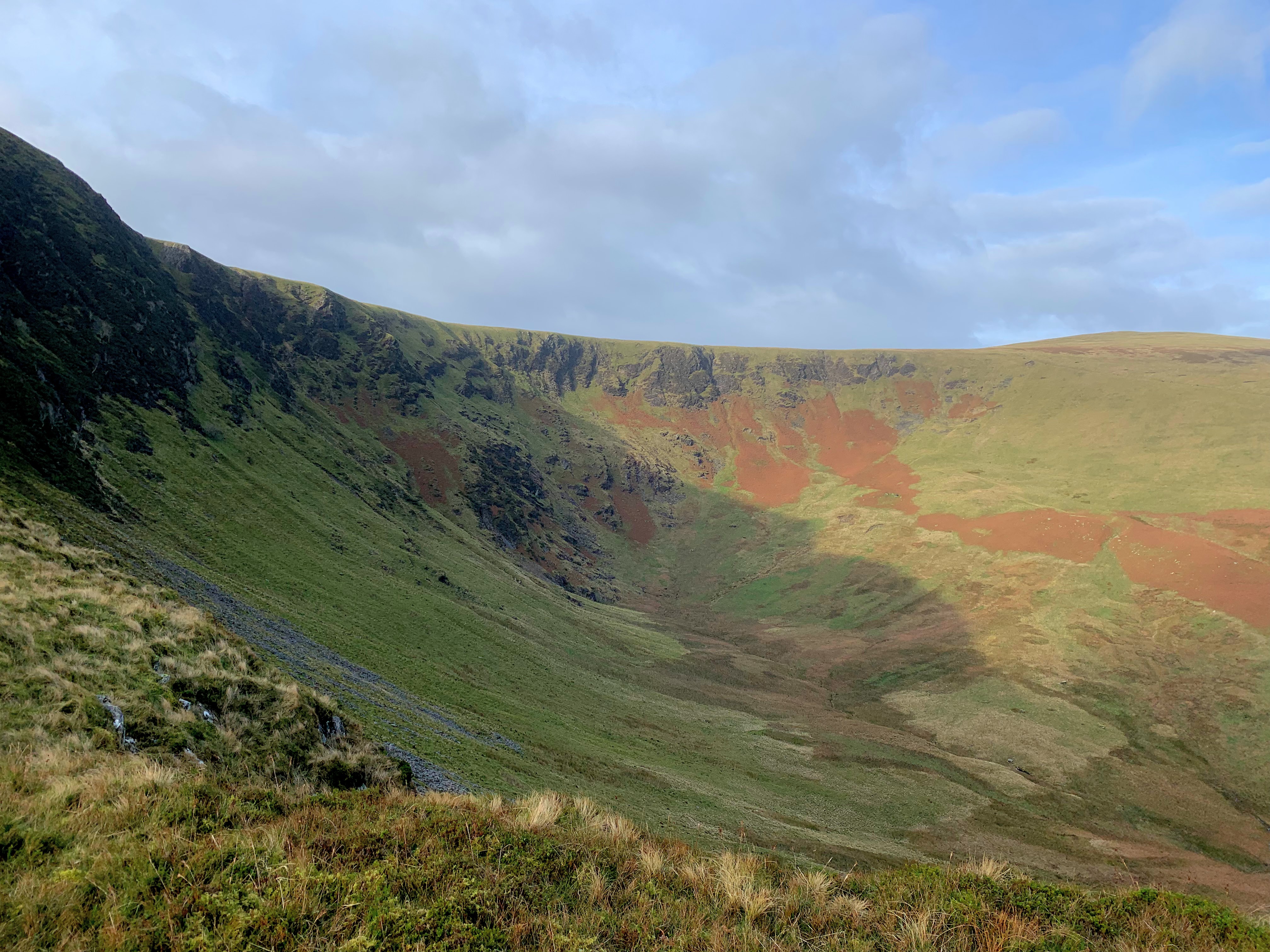
This route does not require advanced technical skills but there is a little rocky section just before reaching the top of Bannerdale Crags. Again, the views of the Crags are quite impressive from that path.
If the weather conditions are too wet or you would like to bag an extra Wainwright; extend the walk y taking the path on the other side of the river and take in Souther Fell.
Once at the top, you’ll get a good view of Sharp Edge and Blencathra.
Hope you have a taken good layers with you. Even though it was a sunny clear day; it didn’t take long for my gloves and hat to come out of the bag. The flat plateau is very exposed to the wind.
For lunch, there is a shelter the top of Bowscale Fell or you can wait until you have reached the tarn.
We decided to enjoy the tarn rather than bag Tarn Crags Top on that day.
Going down to the tarn is a steep and grassy path. Nothing technical but mind your knees.
Again, you could take a gentler way down and bag another Wainwright by avoiding the tarn and descending towards Tarn Crags
Stats
| Difficulty | Strenuous |
| Length | 7.6 mi – 12.2 km |
| Total elevation | 2,018 ft – 615m |
| Highest point | 2,192 ft – 668m |
| Walking time | 3h25 |
| Terrain | footpaths, rocky paths, boggy paths, road |
| Equipment | Good shoes, it can get muddy in places. Enough water to last you for 4 hours. This is quite a strenuous ascent. Layers as the top is really chilly and windy. |
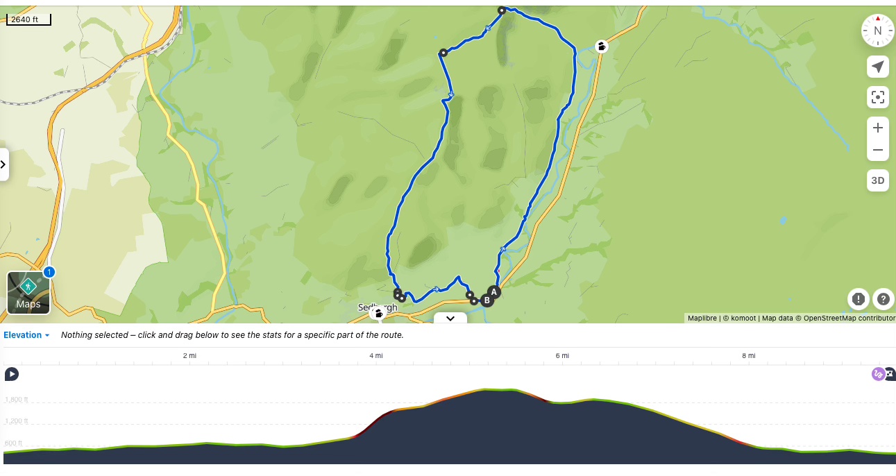
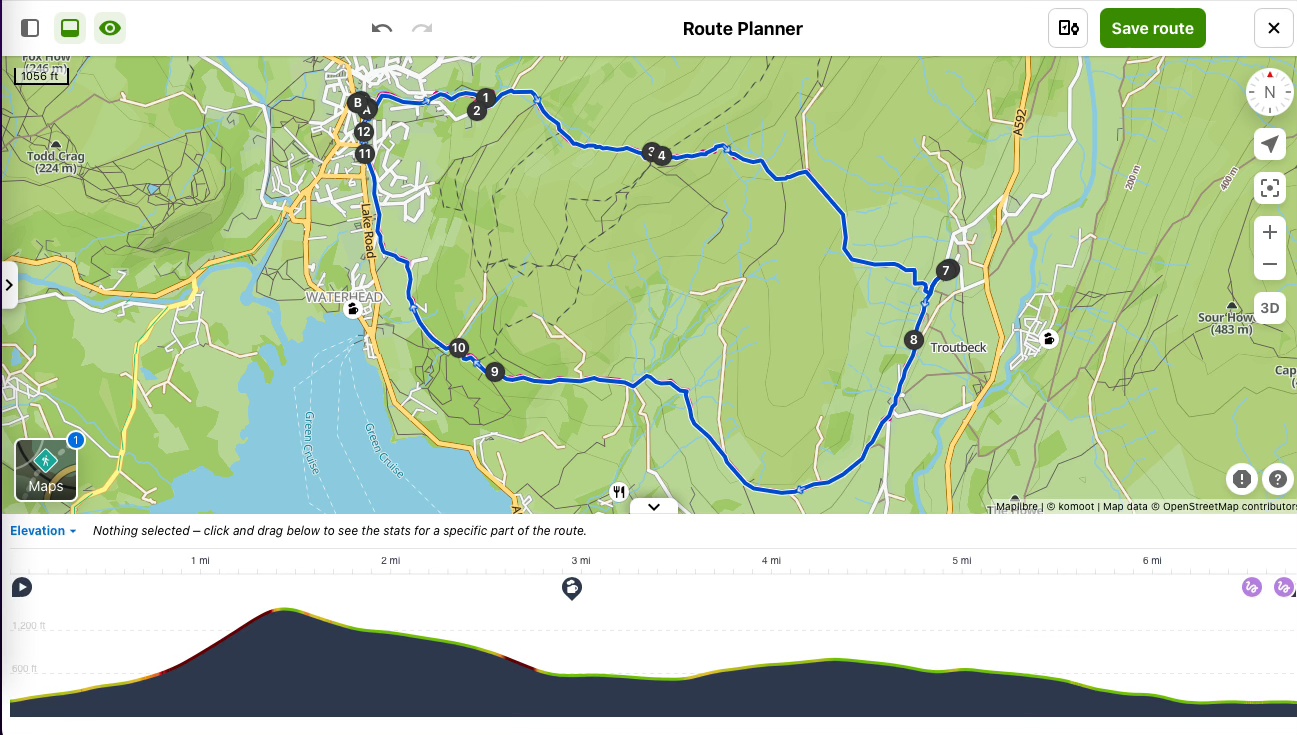
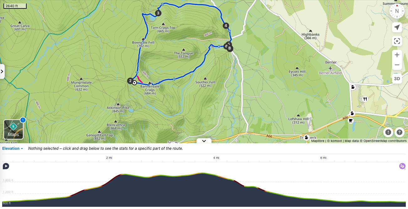
View route (Click on menu to reveal the image)
Getting there
- Driving: Car Park in Mungrisdale
- Public transport: Unfortunately, this is not an easy to walk to access by public transport.
Watering Holes
- The Mill Inn – Mungrisdale – at the beginning or end of the walk.
Part of the Robinson’s brewery. This is the only pub in Mungrisdale.
Muddy boots and paws are welcome and the atmosphere is friendly.
There is a beer garden for the summer and roaring wood-fires in winter.
Selection of real ales and delicious home-cooked food.
Expect traditional pub fayre and roast dinners on Sundays. But please note the pub is closed on Mondays and Tuesdays.
Make a week-end of it – Where to stay and eat
Mungrisdale is ideally situated for a week-end of walking and cycling. It is located on the cycling Coast to Coast route.
And there are numerous fell and lower level walks starting from the village.
With only one pub and one tea-room; it is the ideal place to spend a peaceful week-end away from the hustle and bustle.
For a cosy Inn: The Mill Inn offers
This 17th Century Inn offers half a dozen rooms.
The rooms are cozy and dogs are welcome.
.