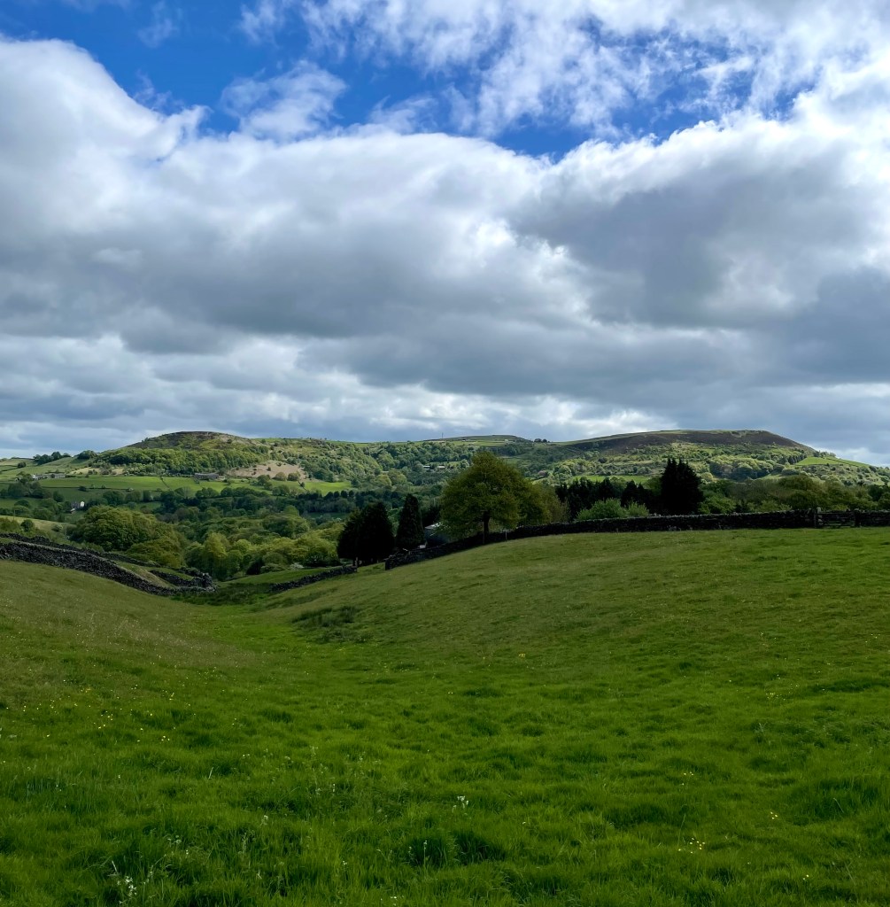
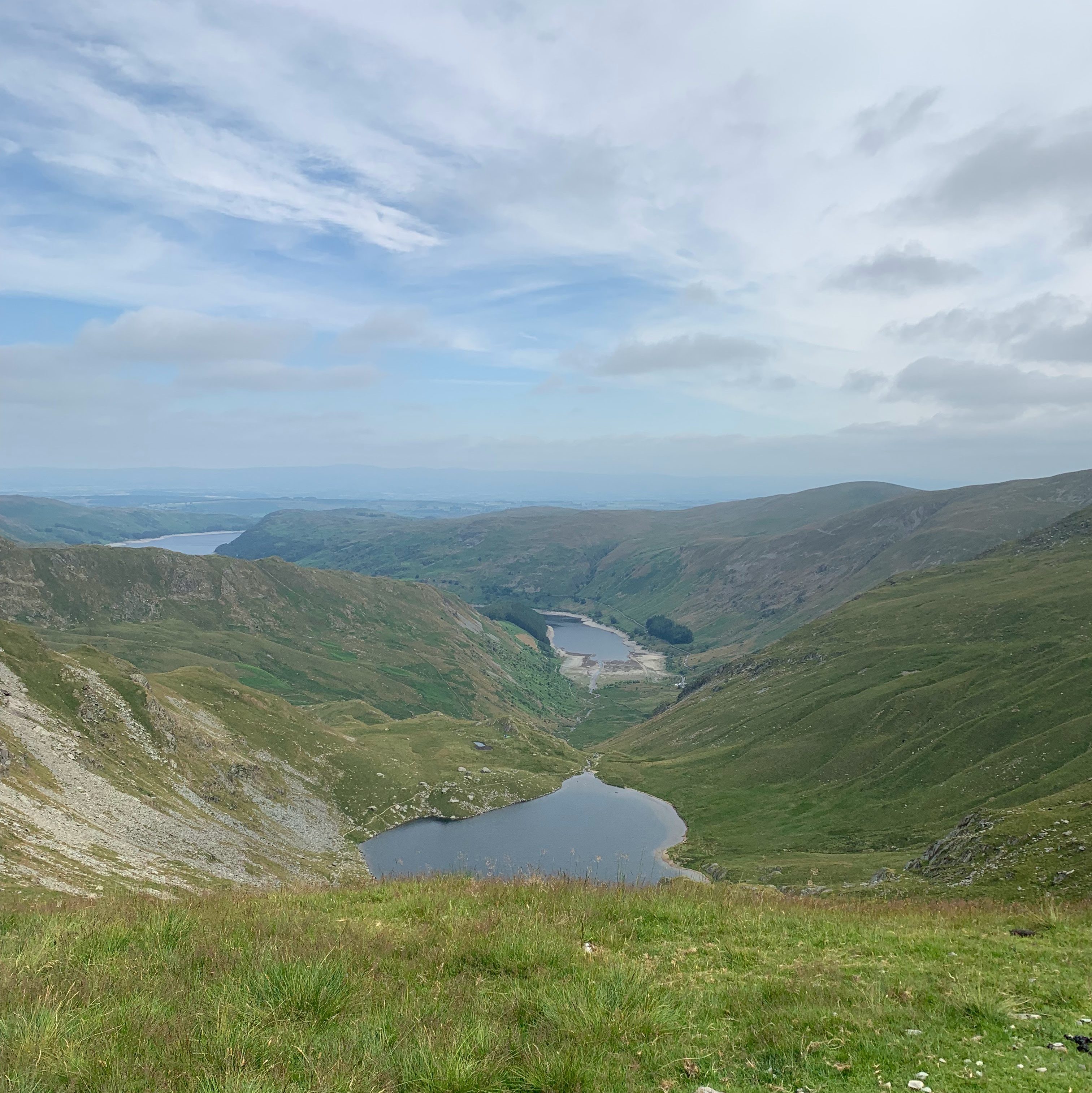
This is a beautiful and lesser-trodden horseshoe in the Lake District. Ideal if you are looking to bag a few Wainwrights, it includes Mardale Ill Bell, High Street, and Kidsty Pike. If you are keen to maximise your numbers, you can also take a short detour to include The Knott and Rampsgill Head. If you simply want a scenic high-level route, this is a rewarding option that’s not overly demanding. Just be mindful, it can get quite windy up there, so it’s best saved for a clear, calm day. And for wild swimming fans: consider doing the loop in reverse so you can end with a refreshing dip in Small Water.
Stats
| Difficulty | Moderate to Strenuous – No technical skills required. But a fair amount of Elevation. And some alpine paths. There is a very mild scramble on the descent. |
| Length | 7.9 mi – 12.2 km |
| Total elevation | 2,687 ft – 819m |
| Highest point | 2,703 ft – 824m |
| Walking time | 5h00 |
| Terrain | Walking paths, Alpine paths (including some very mild scramble) |
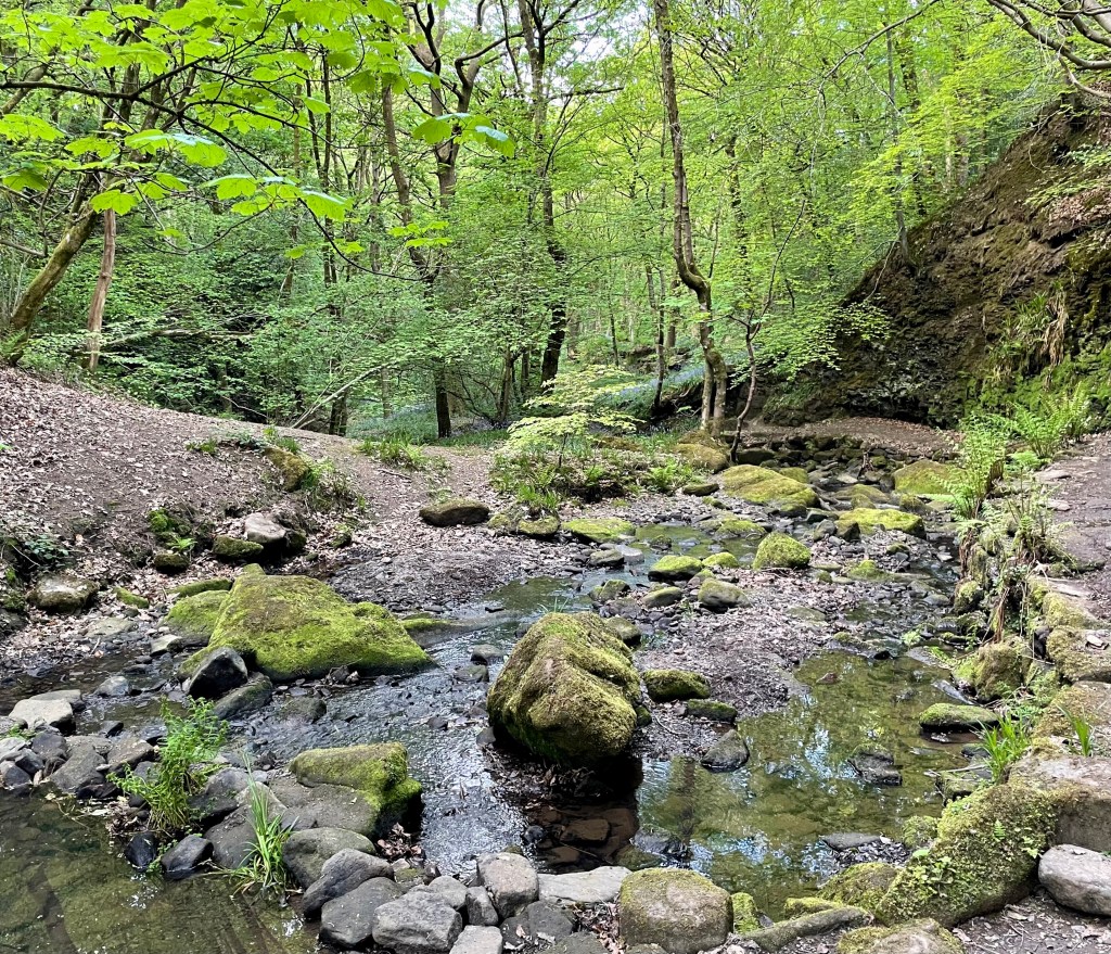
| Equipment | Enough water to walk for 5 hrs. There are no pubs or cafes en route or nearby. There are some streams on the way up (until c. 2 miles) and on the way down (c. 5.9 miles) but being on a ridge; nothing in between. Also, think about layers, layers, layers ! It could be a stunning day in the valley but at over 2,500 ft; it can get cold. And again; you will be on ridge, be prepared for the wind-chill. |
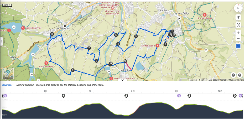
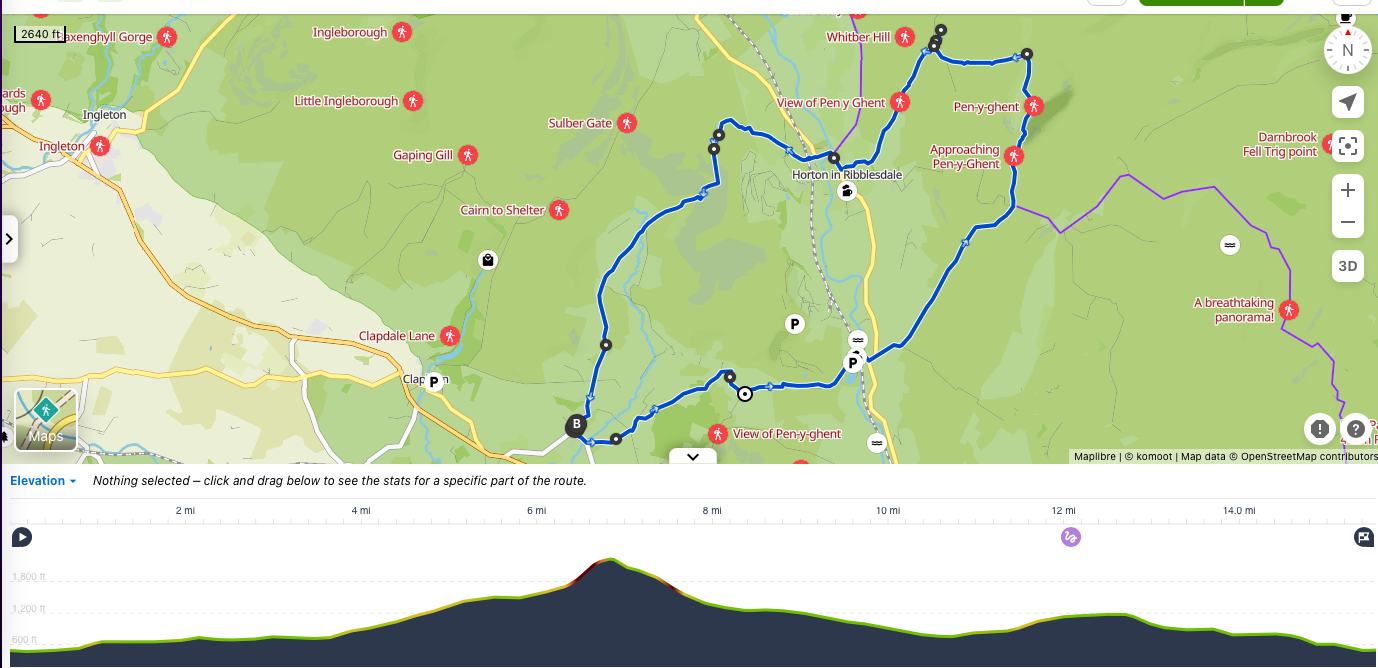
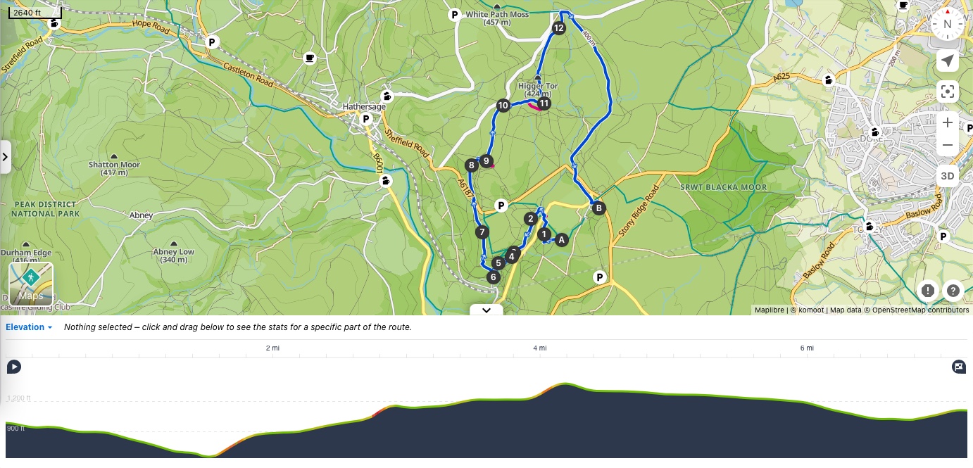
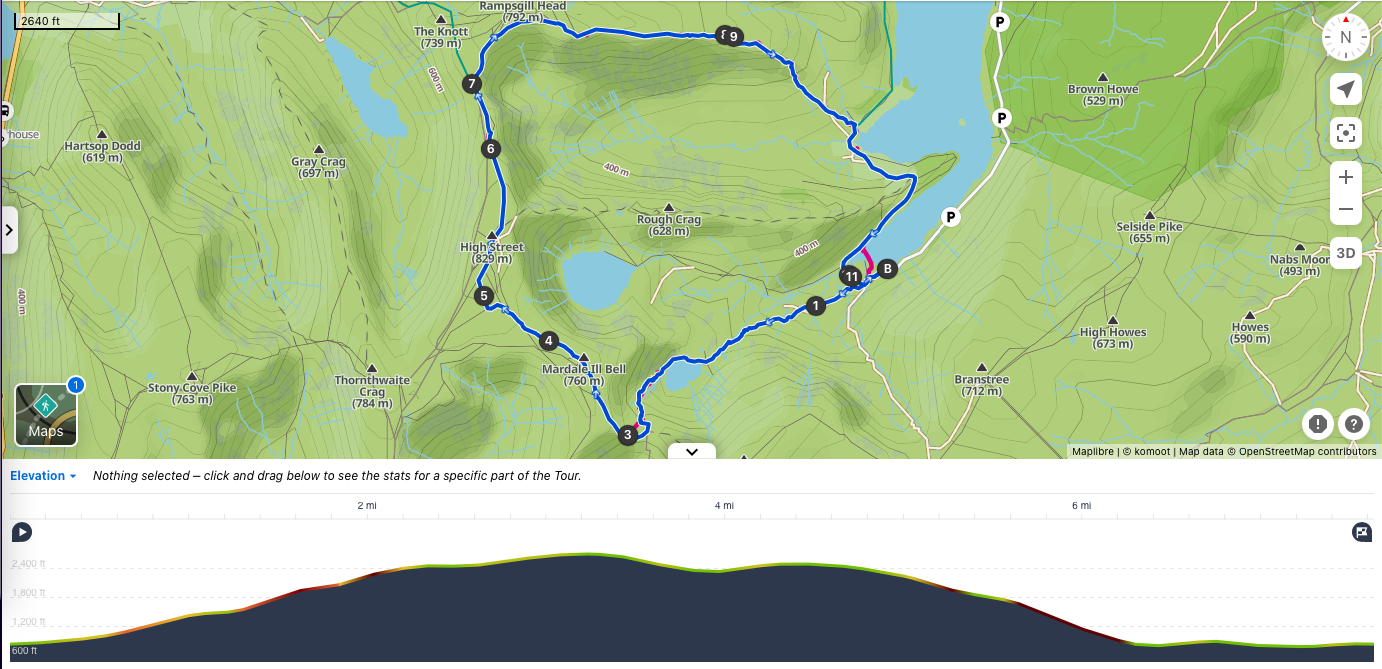
View route (Click on menu to reveal the image)
Getting there
- Driving: Free car-park for 25 cars at Mardale Head, the start of the walk
- Public transport: Sadly, this walk cannot be accessed by public transport
Watering Holes
- Unfortunately, there are no pubs or cafes within walking distance of this walk. But within a short drive:
- The Mardale Inn – Bampton – 16 mins drive
A fantastic community pub. CAMRA approved for its ale.
Closed on Wednesdays. Dinner is served Mon-Tue and Thur – Sat from 16:30-20:30, closes at 19:00 on Sunday. Lunch is available Fri and Sat from 12:00. to 14:00 and Sunday from 12:00-14:30. But you must book ahead for food. Expect pub classics as well as roasts on Sundays. But also some restaurant dishes such as grilled seabass with salsa verde.
Bampton is famous for being the filming location of Withnail & I. - The Punchbowl Inn – Askham – 24 mins drive
My favourite in the area, a traditional country inn dating from the 18th Century. Muddy paws and boots are welcome. Sit outside in the Summer and by the cosy fire in winter.
Fresh, local and home-cooked food is served Mon-Sat from 12:00-15:00 and 17:00-21:00 continuous service on Sunday from 12:00-19:00. Expect pub classics and Sunday roasts.
Good selection of ales and the pub has its own micro-brewery. It also has 6 bedrooms.
Make a week-end of it – Where to stay and eat
For walkers and film fans: The Mardale Inn – Bampton
An amazing Community pub with rooms.
See above for more details on the pub. The Inn has 6 cosy rooms. The bed mattresses use Herdwick wool from the are. Toiletries are made in the Valley. The Inn will help you plan (and load routes) for walks nearby if you do not fancy the above. They work closely with the local RSPB reserve to propose activities. Bampton village was used as filming location for Withnail & I; the village’s phone-box has a guest book for the all fans of that classic movie.
For walkers and history fans: The Punchbowl Inn – Askham
A very cosy Inn from the 18th Century.
See above for more details on the pub. The Inn has 6 cosy rooms.
Askham Hall (Lowther Castle) is on its doorstep. A fantastic place to spend the Sunday, soaking in the history and visiting the beautiful gardens.
For the luxury seekers: The Hawswater Inn listed in the 100 best place to stay in the UK by the Times Newspaper and a two rosettes restaurant. This is a beautiful property in a stunning location. A couple of minutes drive from the start of the walk. I cannot vouch for it personally but believe the service and comfort are top-notch. However; rooms cost £150 for no view and up to £380 per night. This is the best place to disconnect (no phone signal and slow wi-fi) for a romantic week-end as long as your budget is not limited.