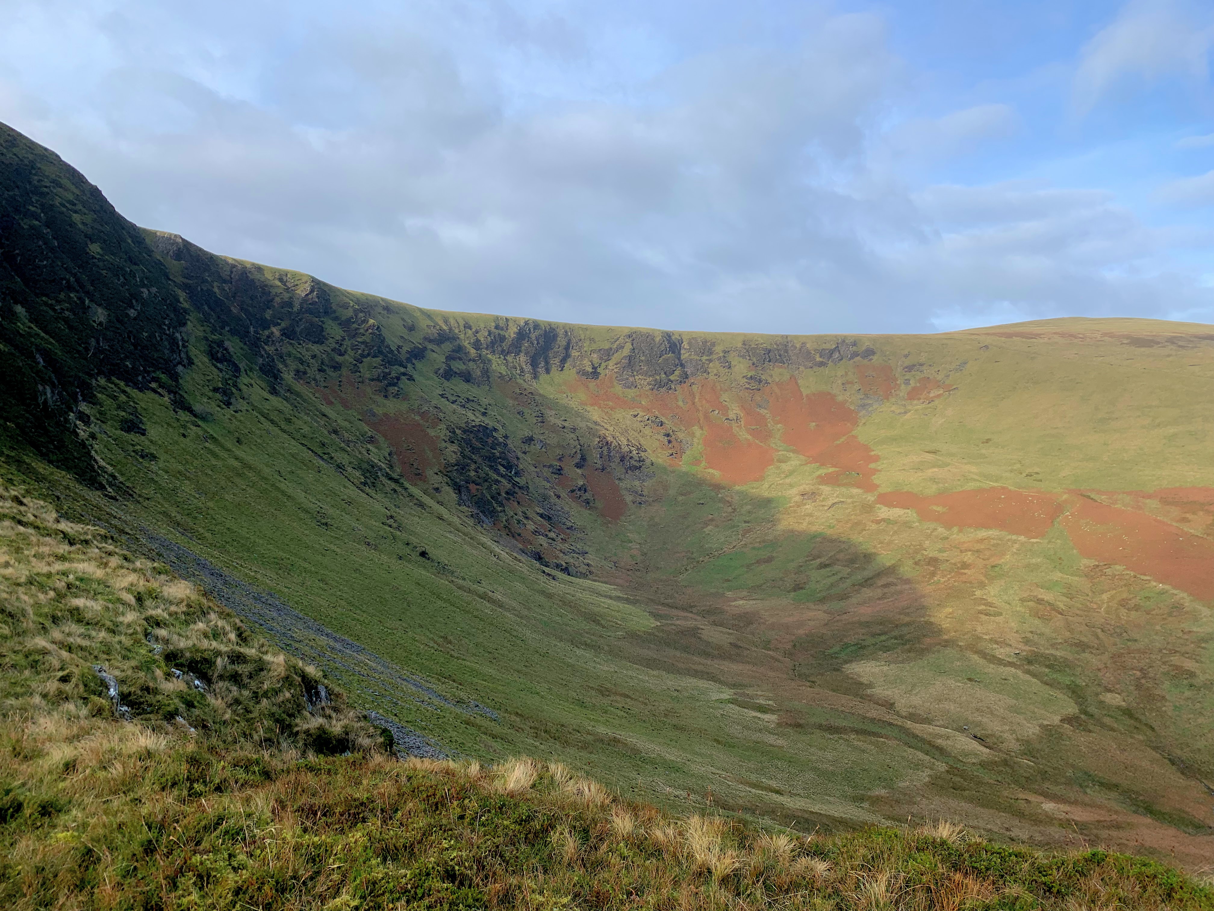
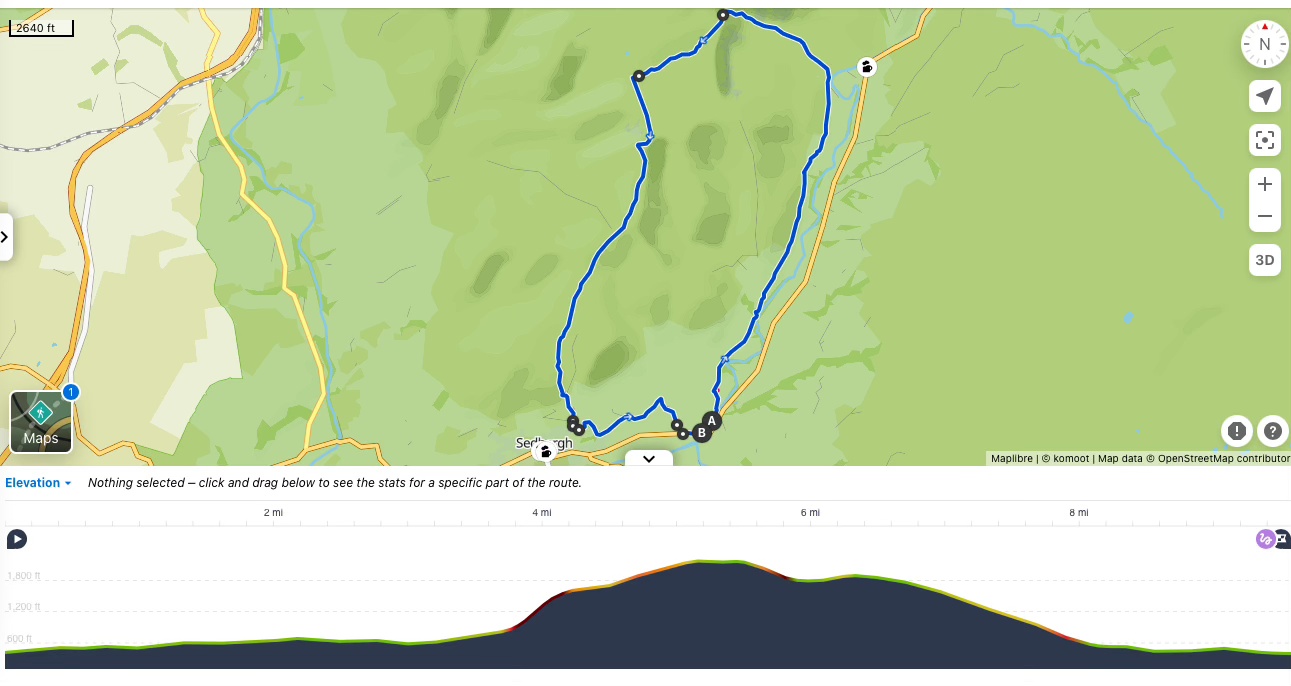
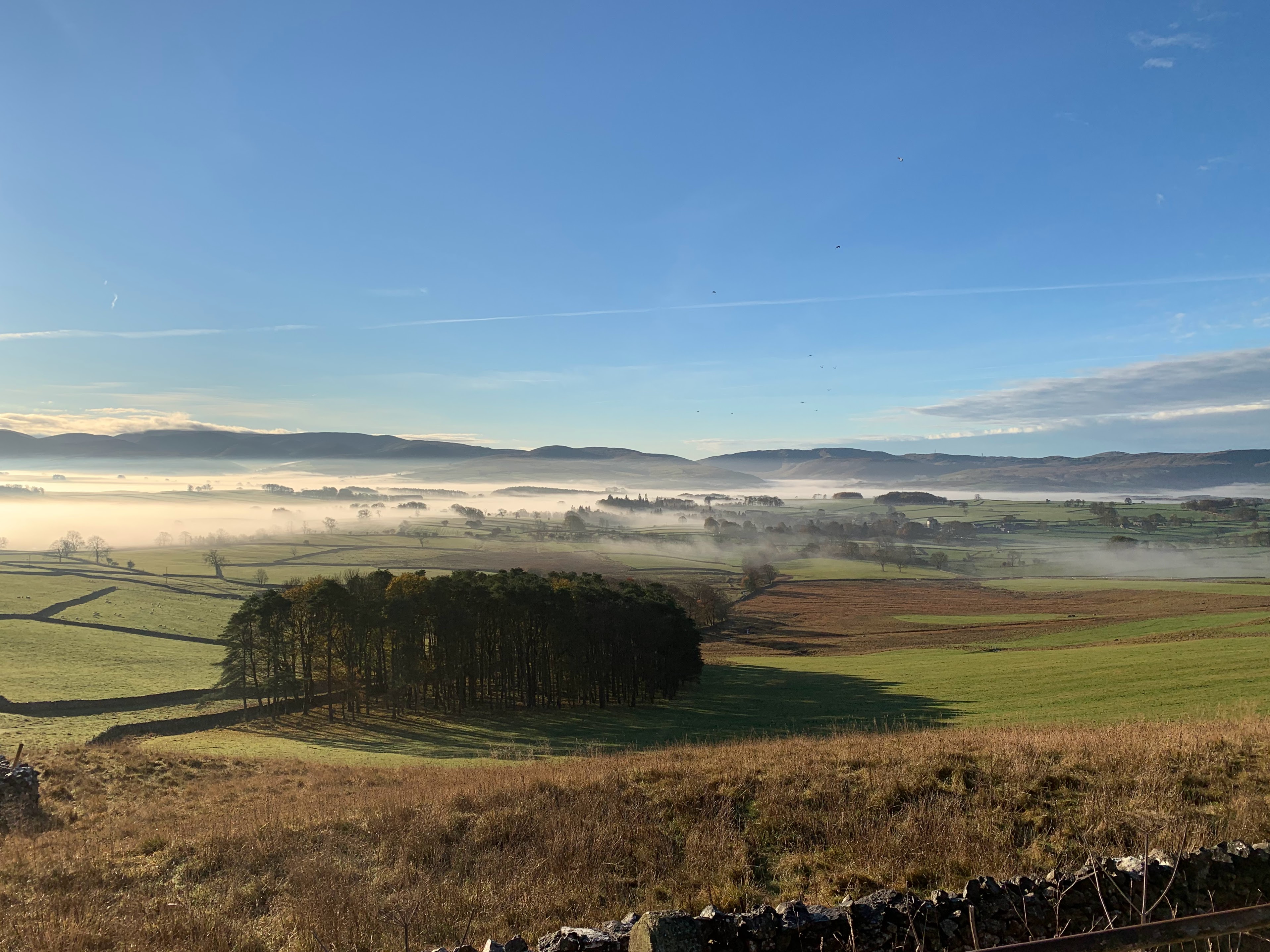
This is a fairly flat walk with no hills to climb or dramatic ups and downs but still takes 1,600 ft of total elevation. Starting at Orton Scar and ending in Appleby; it takes in part of the Dales Way.
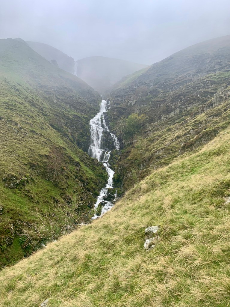
A little more than half way through; you will find Rutter Force – this is an ideal spot to stop for your packed lunch or a break.
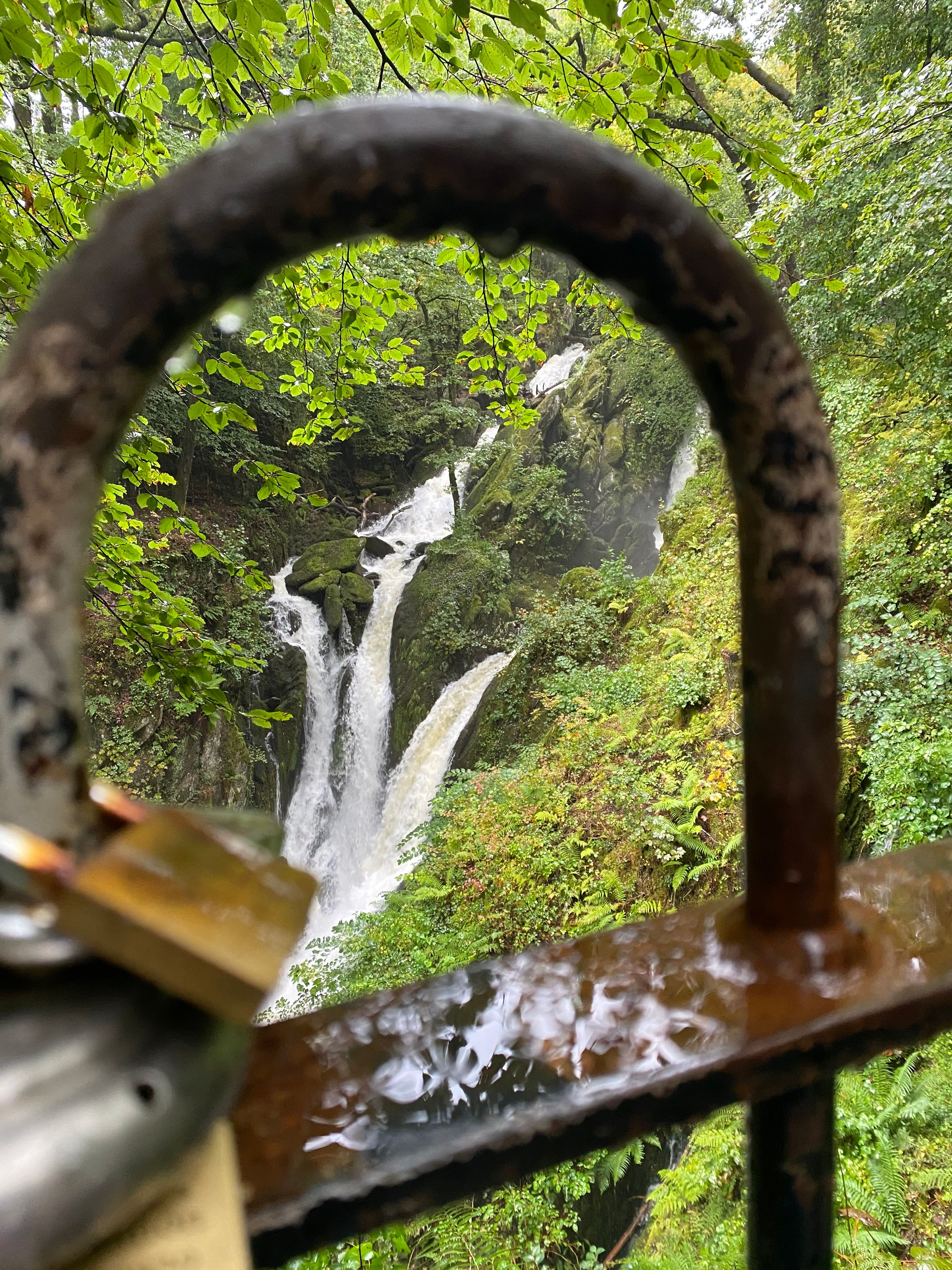
Rutter Force is a man-made waterfall that feeds a water wheel.
It dates back from 1579! The original wheel has been replaced since then; and the mill has been converted to an AirBnB.
But it was initially set-up as a corn mill and later converted to a bobbin mill in 1832.
Eventually turned into a saw mill and later used to power the local church and residents with electricity. The National Grid did reach the area in 1952 and the wheel has been used a decorative feature ever since.
There are no technical skills required for this route and it can be completed year-round. But make sure you have good boots or shoes as it can get muddy in places. And ensure you take enough water and snacks to sustain you for the 11 miles as there are no facilities en-route.
Stats
| Difficulty | Moderate |
| Length | 11 mi – 17.6 km |
| Total elevation | 1,165 ft – 355m |
| Highest point | 1,246 ft – 380m |
| Walking time | 4h00 |
| Terrain | mostly footpath and bridleways |
| Equipment | Good shoes, it can get muddy in places. Enough water to last you for 4 hours. Plenty of snacks as there are no facilities en route |
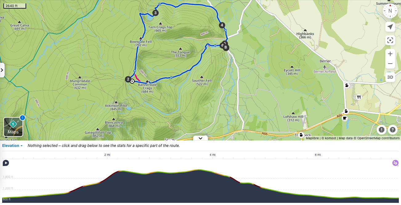
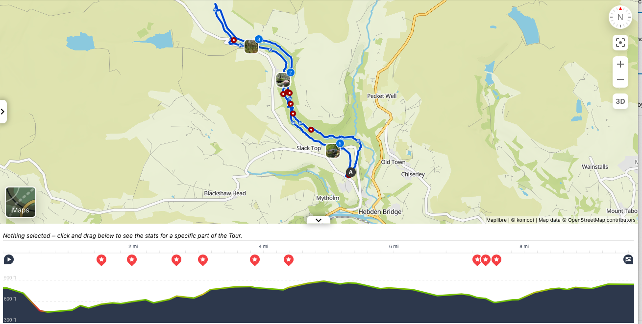
View route (Click on menu to reveal the image)
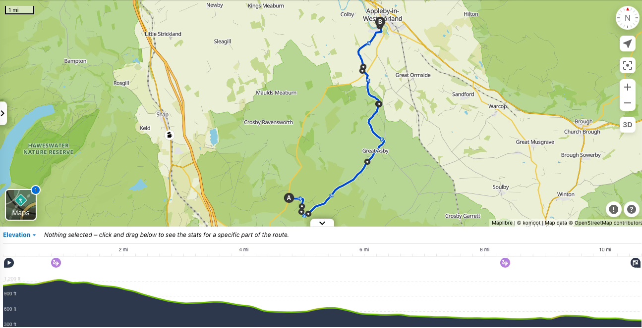
Getting there
- Driving: This is a linear walk – you will need to cars. One at the start point and the other in Appleby in Westmorland.
The start car-park is after the village of Orton and Orton Quarry (if coming from the south / west) on the B6260 - Public transport: Unfortunately, this is not an easy to walk to access by public transport.
Watering Holes
- The Crown and Cushion Inn – Appleby in Westmorland – at the end of the walk.
A cosy and traditional Cumbrian pub with rooms.
Muddy boots and paws are welcome and there is a beer garden for the Summer.
The food is home-cooked. Expect traditional pub fayre and it is open from breakfast.
I really enjoyed my traditional minted lamb hot-pot.
The kitchen is open from 08:00 to 20:30 every-day.
Make a week-end of it – Where to stay and eat
Appleby in Westmorland is a very nice town to spend the week-end. But avoid during the Appleby Fair, usually on the first week of June .
There are plenty of walking and cycling routes around in the superb Eden Valley.
And is a good spot for foodies. Appleby Creamery makes Appleby brie cheese. And if the weather is too bad to walk; the castle has an interesting centre of Norman History
There are several pubs, cafes and restaurants as the main economy in town remains the tourism industry.
For a cosy stay that doesn’t break the bank: The Crown and Cushion – Appleby in Westmorland
This Robinson Brewery owned inn offers 5 comfortable rooms, including a one bedroom self-contained cottage.
For a unique and romantic experience: Appleby Castle – Appleby in Westmorland
The Castle offers a dozen bedrooms and self-contained cottages.
All decorated in individual and traditional style, many of the bedrooms in the castle have 4 poster beds.
Those most striking rooms do not come cheap but are perfect for a week-end celebrating special occasions.
For the more budget conscious, there are more affordable rooms in the old servant’s quarter.
Dinner is served in the 15th Century dining room. And offers both tasting menu and a la carte.
For a unique family experience: The cottage at Rutter Force – Great Asby
With a balcony over-looking the force and just above the water wheel; this is a unique place.
And a chance to spot red squirrels during your morning coffee.
The cosy cottage can be rented via AirBnB and has 2 bedrooms.
But you can only check-in on Mondays and Fridays.
As the place is quite quirky the owner does not accept children under 12 years old. This is purely for safety reasons.
Both rooms have double beds (no twins) and one of the bedroom is behind a curtain on the mezzanine.
As any quirky places; love it or hate it. But for wild-life lovers or any one seeking a different experience, this is an ideal place to spend a couple of nights.